SinergiseinSentinel Hub BlogNew Copernicus Data Access Service to Support the Ecosystem for Earth ObservationA new service to better exploit the EU’s Copernicus satellites dataDec 20, 2022Dec 20, 2022
SinergiseinSentinel Hub BlogArea Monitoring — Combining Markers into DecisionsSome examples on how it all fits togetherSep 1, 2020Sep 1, 2020
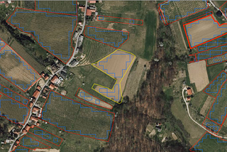
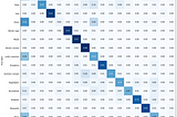
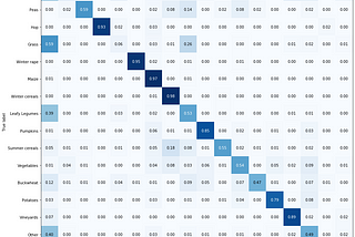
SinergiseinSentinel Hub BlogArea Monitoring — Crop Type MarkerSeparating nuances of crop growth stages throughout the seasonSep 1, 2020Sep 1, 2020
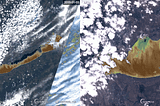
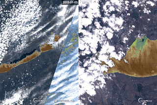
SinergiseinSentinel Hub BlogArea Monitoring — Mowing MarkerIs it possible to detect grass being mowed from 792 km away?Sep 1, 20202Sep 1, 20202
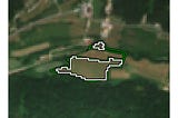
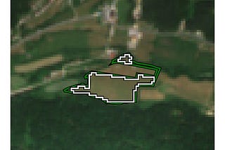
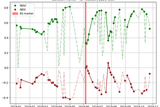
SinergiseinSentinel Hub BlogArea Monitoring — Bare Soil MarkerDetecting ploughing, harvest and similar eventsSep 1, 2020Sep 1, 2020
SinergiseinSentinel Hub BlogArea Monitoring — Similarity ScoreLearning from peersSep 1, 2020Sep 1, 2020
SinergiseinSentinel Hub BlogArea Monitoring — Data HandlingHow not to get overrun with vast volume of available dataSep 1, 2020Sep 1, 2020
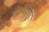
SinergiseinSentinel Hub BlogArea Monitoring ConceptOn trying to build a generic service for a Common Agriculture Policy market, that has been from the very beginning, for decades, served by…Sep 1, 2020Sep 1, 2020
SinergiseinSentinel Hub BlogSentinelhub-js — open-source library for satellite imagery powered web applicationsIntroducing JavaScript/TypeScript library for seamless integration of Sentinel Hub and other similar EO web services in web or node.js…Mar 31, 2020Mar 31, 2020
SinergiseinSentinel Hub BlogWater Quality Information for EveryoneIntroducing the UWQV, a custom script to dynamically visualize the chlorophyll and sediment conditions of water bodies on Sentinel-2 and…Mar 4, 2020Mar 4, 2020