GIS-ishExporting One Shape File to Multiple Shape Files Using PythonAutomating with pythonDec 14, 2022Dec 14, 2022
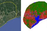
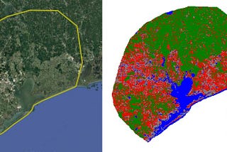
GIS-ishUrban Area Detection Using Landsat ImagesIdentifying urban areas from Landsat image using built up indexDec 3, 2022Dec 3, 2022
GIS-ishPandas — Select dataThere are different methods to select data from a dataframe.Oct 10, 2022Oct 10, 2022
GIS-ishPandas — Missing dataReal world data will have values missing in different columns or rows, thus we have to clean our data before proceeding to any analysis…Oct 7, 2022Oct 7, 2022
GIS-ishPandas — Checking DataIn pandas every change we made in the data has to be checked. For this there are different functions. Let’s look briefly into them.Oct 3, 2022Oct 3, 2022
GIS-ishPandas — ReadPandas is an open-source package for data analysis in Python. It is built on the numpy library and written in languages like Python…Oct 1, 2022Oct 1, 2022
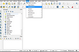
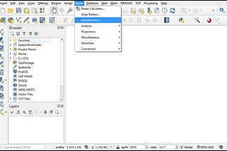
GIS-ishAn insight into Georeferencer tool — QGISFor GIS projects any image used must have a coordinate system defined. Only then the image can be used for different spatial analysis…Sep 21, 2022Sep 21, 2022
GIS-ishPython- Nested loopThis was one of the reasons to start writing this blog. Forcing myself to learn, the nested loop was one of the extra exercises in my…Sep 15, 2022Sep 15, 2022
GIS-ishPython — while loopAnother method for looping through a number of sequence is the while loop. The ‘while’ loop executes the set of statements as long as the…Sep 14, 2022Sep 14, 2022
GIS-ishPython — For loopUsing a loop we can perform calculations on each item. Since bulk processing is the main goal of python repeating processes on loops is…Aug 30, 2022Aug 30, 2022