Mo Sarwat


Mo Sarwat
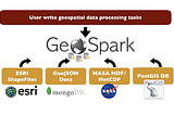
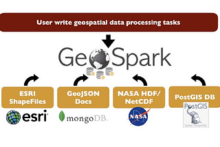
Mo is the founder of Wherobots.ai, CS Prof at Arizona State University, & the creator of Apache Sedona (a scalable system for processing big geospatial data)
Mo is the founder of Wherobots.ai, CS Prof at Arizona State University, & the creator of Apache Sedona (a scalable system for processing big geospatial data)