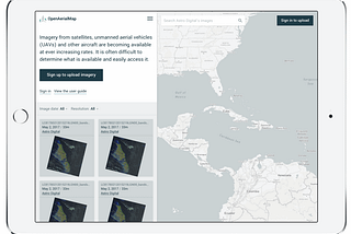
Nate SmithinOpenAerialMapGrowing the OpenAerialMap communityOpenAerialMap enables sharing images from the air with people on the ground. Today we’re launching a new campaign to help show how images…May 18, 2018May 18, 2018
Nate SmithinOpenAerialMapA New OpenAerialMapOver the past two years, users have contributed thousands of images to OpenAerialMap and it has become a critical resource for distributing…Oct 23, 20171Oct 23, 20171
Nate SmithinOpenAerialMapNew in OAM: User AccountsAlong with a new look and feel, you can now access and manage your imagery with a user account. We’ve updated our authentication system to…Oct 23, 2017Oct 23, 2017
Nate SmithinOpenAerialMapNew UAV imagery supporting humanitarian mapping efforts in recent major disastersOver the last few weeks, a number of disasters have impacted millions of people worldwide. Hurricane Irma, Sept 8 Earthquake in Mexico…Oct 13, 2017Oct 13, 2017
Nate SmithinOpenAerialMapOpenAerialMap at the World of Drones CongressWe just wrapped up the World of Drones Congress in Australia where we showcased OpenAerialMap. The World of Drones Congress was a first for…Sep 1, 2017Sep 1, 2017
Nate SmithinOpenAerialMapBeta testing user accountsWe’re currently beta testing new features to make it easier to manage your contributions to OpenAerialMap (OAM). These are exciting new…Aug 14, 2017Aug 14, 2017
Nate SmithinOpenAerialMapUploading made easier: new options available for OpenAerialMapSince OpenAerialMap launched we’ve required imagery to be stored in a publicly accessible place prior to upload. This enable us to focus…Apr 3, 2017Apr 3, 2017
Nate SmithinOpenAerialMapGrowing OpenAerialMap with Responsible ImageryHOT is working to grow OpenAerialMap to be a long-lasting open imagery resource to OpenStreetMap and humanitarian communities. With new…Feb 13, 2017Feb 13, 2017
Nate SmithinOpenAerialMapMaking open imagery accessible: OpenAerialMap comes out of betaOpen satellite and aerial imagery can be difficult to find, access and use. For HOT and our humanitarian partners, open imagery has been…Jan 31, 2017Jan 31, 2017
Nate SmithinOpenAerialMapSupporting Humanitarian Response with Better Imagery CoordinationPre- and post-disaster satellite imagery is a critical resource for HOT and many humanitarian response organizations. Coordination of…Nov 23, 2016Nov 23, 2016