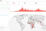
Paul KnightinDigital and innovation at British Red CrossThe impact of Missing Maps at British Red CrossThe British Red Cross is a founder and maintainer of the Missing Maps project. Later this year, the project will be 10 years old, and over…Mar 21Mar 21
Paul KnightinDigital and innovation at British Red CrossEnhancing the Needs Assessment process at the Nigerian Red CrossThe Nigerian Red Cross supported by the British Red Cross held a series of workshops to review the current needs assessment process.Dec 4, 2023Dec 4, 2023
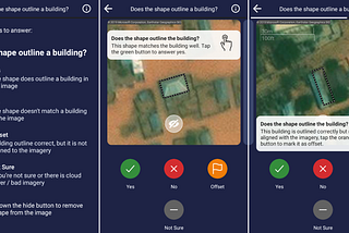
Paul KnightinDigital and innovation at British Red CrossUsing MapSwipe to validate building quality data in NigeriaWhat if building outlines and roads had been added to OpenStreetMap previously? We share our experience using MapSwipe to improve map dataOct 19, 2023Oct 19, 2023
Paul KnightinDigital and innovation at British Red CrossAsking “So what?”: Transforming data into action with the Nigerian Red CrossWhat is going on? How and why is this important? What will happen next? But how do you go about answering these during disaster response…Feb 8, 2022Feb 8, 2022
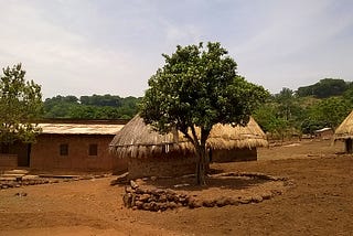
Paul KnightinDigital and innovation at British Red Cross“This is the first time this community is on a map…” — Digital Community Mapping in NigeriaIn 2021, the Nigerian Red Cross supported by the British Red Cross added communities it is working with on a map for the first time…Nov 17, 2021Nov 17, 2021
Paul KnightinDigital and innovation at British Red Cross3 Steps to Data Readiness with the Nigerian Red CrossThe British Red Cross GIS and Information Management Team are supporting the Nigerian Red Cross build data capacity for disaster response…Nov 4, 2021Nov 4, 2021
Paul KnightinDigital and innovation at British Red Cross2020 Reflections: GIS and Information ManagementWow, 2020 — what can we say! At the beginning of the year we had little idea of what would unfold, or how it would shape the work we…Apr 15, 2021Apr 15, 2021
Paul KnightinDigital and innovation at British Red CrossImproving the efficiency of deploying volunteers to an emergency using GISHow can GIS improve the efficiency of emergency response, deploying vehicles and volunteers?Mar 23, 2021Mar 23, 2021
Paul KnightinDigital and innovation at British Red CrossInformation Management, GIS and Missing Maps for a Guinea Maternal Health ProjectThis is a look back at a project the GIS team supported between 2016–2019, with information management and mapping.Nov 20, 20201Nov 20, 20201
Paul KnightinDigital and innovation at British Red CrossUsing Open Geo Data to Strengthen Urban Resilience in NepalThe SURE programme incorporates the use of open geographic data as part of urban assessments and specifically Hazard MappingNov 10, 2020Nov 10, 2020