Tarık Emre YorulmazHow to Perform Accuracy Analysis of Classified Image in Remote Sensing?Image classification is one of the most common applications of remote sensing and is used in many fields. The maps obtained as a result of…Jul 9Jul 9
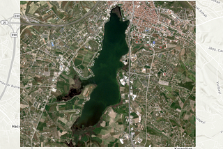
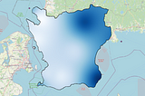
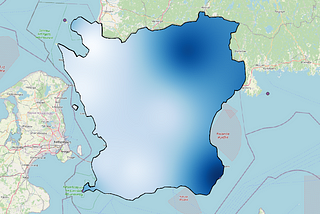
Tarık Emre YorulmazMapping Water Quality Parameters with PlanetScope Satellite Imagery: Case Study of Mogan Lake…Compared to field measurements, mapping water quality parameters with remote sensing is possible in a shorter time and with less effort…Jul 41Jul 41
Tarık Emre YorulmazQuantifying Urban Sprawl: Applying Moran’s I Technique on CORINE Land Cover DataUrban growth is seen as necessary for a sustainable economy. However, uncontrolled growth can lead to various environmental, social and…May 222May 222
Tarık Emre YorulmazGreen Space Mapping with Remote Sensing: Case Study of Judarskogen Nature Reserve (Stockholm)Green areas make various contributions to both human health and environmental health in cities. One of the things that need to be done in…Mar 13Mar 13
Tarık Emre YorulmazUrban Heat Island Modeling with GIS-RS for Kocaeli province and Examination of its Relationship…Urban heat islands are metropolitan areas that are created by increased population and impermeable surfaces and are significantly warmer…Feb 222Feb 222
Tarık Emre YorulmazBioclimatic Comfort Mapping in the Skåne Region using Discomfort Index and GISBioclimatic comfort defines the most suitable climatic conditions in which people feel healthy and dynamic. Bioclimatic comfort maps are…Jan 30Jan 30
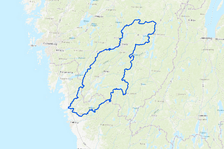
Tarık Emre YorulmazGIS Based Soil Erosion Risk Mapping using RUSLE Method; Case Study of Viskan BasinErosion is the movement of soil from its location by water or wind [1]. It is divided into two: natural erosion and accelerated erosion…Dec 28, 20231Dec 28, 20231
Tarık Emre YorulmazUse of GIS in the Analysis of Traffic AccidentsIdentifying areas where traffic accidents are concentrated has an important role in developing new strategies to minimize accidents. In…Nov 23, 2023Nov 23, 2023
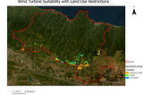
Tarık Emre YorulmazDetermination of Potential Wind Power Plant Areas in Ordu Province with GIS Based MCDM-AHP MethodsThe rapid increase in population all over the world, the insufficiency of existing non-renewable energy resources and the rapid development…Oct 13, 20231Oct 13, 20231
Tarık Emre YorulmazAutomatic Flood Mapping using Sentinel-1 SAR and Otsu Method on Google Earth Engine: Case Study of…Flood events, which are one of the most common and destructive natural disasters in the world, cause great loss of life and property. In…Jul 24, 20231Jul 24, 20231