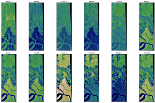
Hem Bdr BhattaraiSatellite Imagery Analysis using Python — Importing Packages and Reading Satellite dataTo perform different operations on the data, we are going to use libraries such as EarthPy, RasterIO, Matplotlib, Plotly for Data…May 25, 2022May 25, 2022
Hem Bdr BhattaraiHow to install libraries using ANACONDA for geospatial analysisPython is a great tool for spatial analysis and geomachine learning, however sometimes the Windows operating system presents some…May 25, 2022May 25, 2022
Hem Bdr BhattaraiSatellite Imagery Analysis using Python — Soil Indices (SAVI and VARI)There is a large number of spectral indices that can analyze various aspects such as vegetation, water resources, snow, soil, fire, among…May 25, 2022May 25, 2022
Hem Bdr BhattaraiSatellite Imagery Processing using Python — Creating a raster mosaicWhat is Mosaicing in image processing?May 25, 20221May 25, 20221