Camping at Watersprite Lake
A distinctly British Columbian experience

Before we leave Vancouver and Canada, it became important to experience British Columbia as it is just as great of a place to explore as the places we will see in the coming year. We are about to embark on a year of travel and wanted to appreciate home first.
Departures is one of my favourite TV shows and an inspiration for many travellers. It follows three Canadians who travelled the world over three seasons. Because they are Canadians, the first episode features a road trip across Canada from East to West. Their intent was to see their home country before going abroad. In a similar tone, Yuki and I wanted to have a great Canadian experience before going overseas and visiting other countries. This post is about that experience.
It began with an invitation from Haney to go on an overnight camping trip to Watersprite Lake near Squamish up the Sea-to-Sky Corridor. It would be an understatement to say that I was excited. Watersprite Lake isn’t a hike I’d heard of before but I became instantly intrigued once I saw a few photographs of the lake. It looked as epic as Garibaldi Lake, but not nearly as well-known and thus much less busy. Since Haney, Elliot, and Frances are still working, the trip happened on Saturday and Sunday.
We had plenty of time to plan the trip, and after doing some cost estimating we decided to go with an Enterprise car rental over Modo. This was because Yuki and I opted to do a week-long rental so we could travel to Vancouver Island after the camping trip. I went to pick up the rental car on Friday just before closing time at 5pm. Meanwhile, Yuki stayed home to transfer data from her work iPhone to my personal iPhone, which we will share over the coming year. I walked to Enterprise and knew something was amiss when the manager said, “You must be Keenan yeah? Your phone number doesn’t work.”
Even though we had reserved the car weeks in advance, Enterprise called the day before to confirm the reservation. We only get confirmation calls half the time; this time Enterprise called Yuki’s old phone number, which isn’t in service anymore. They must have had the number from a previous reservation; we were not asked to provide a new number with our new reservation. Without any further attempts at communication via email, they cancelled the reservation. The manager offered a Kia Soul or a Honda Civic, but neither of those would work for us. We had intentionally reserved a mid-sized SUV to have the 4WD and ground clearance because the trailhead is about an hour drive down a forest service road (FSR).
Unsure what to do, I gave Yuki a call thinking that I’d have to come home and find an alternative solution. This was reminiscent of our last camping trip with Haney and Elliot, when Elliot went to get a Modo but the car battery was dead and he also didn’t have a cell phone. It took him hours to pick up the car. Like him, I was having trouble getting our ride before the trip had even begun.
Yuki suggested asking about other locations and the manager called two other Enterprise rental offices. The second location had a GMC Terrain, which was likely to work for our purposes. He asked if I could get to Marine and Oak; I said no, because I was trying to rent a car since I didn’t have one. The manager had sent his other employees home for the day and said that he could drive me there if I waited until 6pm, when he closed up the offices. It ended up being an hour later, at 6:30pm when the shop was finally closed up, when we drove over. What should have taken 20 minutes was a 2 hour ordeal.
Frances came over after work to stay the night and we spent the evening doing last-minute coordination and packing our bags. We went to sleep relatively early, 11pm, and were up again at 6am for a 7am departure.
I went to pick up Haney and Elliot while Frances and Yuki went to their office to pick up/drop off some items, and then we met at McDonald’s for breakfast. The drive up to Squamish was smooth and we stopped at a Canadian Tire to check out a camping stove and use the washroom before taking on the FSR.
Interestingly, this was the wrong FSR that we took on a previous trip when trying to get to Elfin Lakes; however, this time we had a printout of the directions as well as three digital maps to confirm the route before setting off.
The drive on the FSR took about an hour, passing over several bridges and skirting around potholes in the road. Generally, the road was in good condition but I drove slowly because I didn’t want to get a flat tire on the rental car.
The last leg of the FSR had some steep accents and descents, but there was only one place where I asked Frances to get out and spot for me so that we didn’t bash up the front bumper.
The parking lot was surprisingly full and we saw several day hikers as well as a few campers on trail. The Watersprite Lake has a cabin that was just finished by the British Columbia Mountaineering Club (BCMC). They also just finished building the last bridge on the trail and are finishing up the campsite. For such a new hike, I didn’t expect to see many people but we probably saw 20–30 on Saturday and another 15 on Sunday.

The trail begins near a run-of-the-river BC Hydro project, and the five engineers in the group took a moment to check out the spillway. We then hiked a kilometer through a small marsh before ascending into the forest. The trail is about 7.5km long; between kilometres 2–4 there is a steady incline with vast switchbacks that climb up the side of the valley. It is curious that the trail is a steady ascent and the grade does not change drastically. There are several stream crossings, but at this time of year, there was no threat of wet feet. The last stream crossing of the hike was about 3–3.5km in, and we took a break for lunch here, not realizing that around the next turn was the open ridgeline.
At the ridge, it became clear that we had climbed up the side of the valley and were standing near the corner of two merging valleys. The slope of the mountains are evident of glaciers with their smooth bowl shapes, and we could see all the way down the valley to Squamish. Beside Squamish, the Chief pokes out from behind another mountain range. Beyond that is the tip of Howe Sound. Looking up the valley, the switchback trail that we had just traversed is evident by the leafy trees that cut through the conifer forest. At the base of the valley is a meandering river that leads to the lake of the BC Hydro project at the trailhead.


We found a massive boulder to get a little more elevation and take photos from. I suddenly found myself taking a lot of panoramas and still not being able to capture the entire scene.
This panoramic view is exactly why we came on this trip. The view is distinctly BC, with deep green forests and undulating blue mountains.

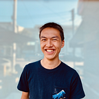
Shortly after, I spotted a rock with an overhang on the edge of the trail. This made for a dramatic set of photos. Frances shot a few photos of Yuki and I together, because I’m trying to get more photos with the both of us.
Rounding the corner, we entered the second valley and continued to hike along the side of the valley. We started to take more frequent breaks and longer rests as the weight of our packs began to really slow us down. Eventually, we neared the end of the valley and the trail turned into a boulder field. It was very humid and hot, and we took even more breaks when we traversed this section. Day hikers that had started at the same time as us passed us on their way down and told us that they had swam at the lake.
We entered another forest section that was surprisingly muddy, given that it was halfway up the valley. The last leg of the hike was a steep climb up the end of the valley. I’ve noticed that a lot of lakes in this region sit at the end of a valley and are held up by a glacial moraine.

Fighting off abundant mosquitoes and flies, we reached the summit and took in views of the lake.
The lake is beautiful. The shallow areas are turquoise clear and have submerged rocks and deadfall that make for interesting compositions. The lake is not large and is surrounded by mountains, the most prominent of which is Dreadnought Peak at the far East end. I ran along the edge of the lake to get pictures before the shadows consumed the lake, as it was getting quite late in the afternoon.


These are the panoramas that I dream of one day printing at a huge scale. I think I underexposed most of them, but they are still quite dramatic photographs.
The BCMC cabin was locked and only reservable through the club. It is also apparently continuously booked on weekends in the summer. The club, however, has created a designated tent camping area at the far end of the lake, ad the base of Dreadnought Peak. There are many signs for ecologically sensitive areas that the club is trying to keep pristine near the lake.
It was rather difficult to get to the campsite, because we had to scramble along the rocks along the edge of the lake and then trample through the wetland shrubs to get there.
There have been enough people that there are a lot of trampled bushes, but not enough people to make actual pathways. We tried our best not to disturb too much nature.

I don’t think Yuki and I have ever gone hiking and gone so far over the estimated hiking time. The sign at the trailhead estimates 4–4.5hrs each way. It took us 7 hours to get to the campsite. I could see how day hikers could easily meet that estimate. For campers with heavier packs, I would have around 6 hours. Our trip was probably so long because we took it slow and stopped for a lot of breaks because it really didn’t matter what time we arrived; we would still have plenty of daylight.
We were exhausted at the end of the hike, so it was fortunate that setting up camp was easy and that we had Alpine Aire dehydrated meals for dinner. All we had to do was boil some water. Frances and Elliot broke out the whisky and we were all happy to stretch out and laze around until it began to drizzle, at which point we retreated into the shelter of our tents.
I had hoped to see the annual Perseid meteor shower and do some star gazing while we were away from the city, but unfortunately after a month of sweltering heat, the rain decided to return for the one day we were camping. I set my alarm for 4am in hopes that I might see something, but it was pouring rain so I promptly fell asleep again and didn’t get up till 10am.
The rain had stopped by then and most of the campers were up and eating. The others were up and had already eaten breakfast when Yuki and I emerged from our tent. Haney cooked an omelette with sausage, which was a great start to the day. I saw some other campers with very wet tents so they probably didn’t have as good a night as we did.

Everyone was well rested, probably because we got up later than intended. The sun was coming through the clouds sporadically, but it was also threatening to rain again so we made quick work of packing up.
As we were climbing over the rocks to get back to the other side of the lake, it started pouring rain. Fortunately, the rocks had a lot of grit to them and so it wasn’t too slippery.

By the time we reached the West end of the lake, the rain had stopped and I climbed higher for another 360 photosphere at the lake.

We were eager to get down and started the descent as it rained on and off. When it rained it poured, but we could see sunny skies in the distance. Midway along at the rock with the overhang, we stopped for lunch. Fortunately, the rain had stopped and it was sunny but that also brought out the bugs. We had pre-cooked Mee Goreng instant noodles in the morning and had hardboiled eggs as well.

The remainder of the hike down was tiresome and slow-going. It took us nearly as long to go down as it did to come up: 6.5 hrs of tiresome slogging. It started to get hot again and all of us were sore. I suppose part of hiking and camping is getting comfortable with being uncomfortable.
We were all relieved to reach the car and not have to carry our heavy packs. The drive out along the FSR was uneventful. After driving back to Vancouver, we went for a late dinner but no one was too hungry and everyone just wanted to sleep. Frances decided to sleep over at our place again and was going to get up early to go into the office at 6am, but ended up calling in sick and slept the whole day.
I’m glad we did this hike because the experience was fantastic. The views were incredible and would be even better with clear skies. Yuki doesn’t think she’d want to do the hike again because it was quite strenuous. We had a debate about whether it was better than Garibaldi Lake or not. I thought that this hike was more interesting because of the ridgeline view is great, the lake is cool, and the hike is shorter — but Garibaldi does have a larger lake and great views from Panorama Ridge.
It’s nice that there aren’t nearly as many people at Watersprite Lake because Garibaldi is turning into a zoo. There were still more than I expected, and I only expect that it will get worse as more people find out about Watersprite. The trail isn’t nearly as developed as the Garibaldi Lake trail, so there were a lot of people that were too impatient to wait for us to step off to the side and instead trampled past us in their haste. Although the logging road is long and might deter some people, it isn’t especially rough and we did see a Fiat 500 Modo in the parking lot, so there will probably be a lot of people hiking this trail once word gets out.

Trail description and directions