New Features: Vaccination Sites & Clinics
By Kenna Camper, Susan Paykin, and Dylan Halpern
In recent weeks, vaccination production and administration have ramped up, with a current rate of about 2.5 million people being vaccinated per day, and a total of 44 million adults in the U.S. have been fully vaccinated. About 25% of Americans have received the first vaccine dose, and daily average new case rates have dropped significantly since January. However, this rate is still high at around 53,000 new cases per day, and the total number of COVID cases has reached over 29 million.
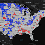
This data, along with a state-by-state breakdown, is available to explore on the US Covid Atlas. We’re also excited to introduce new features to make vaccine sites, federal super-sites, and health clinics easier to find.
Vaccination Updates
Currently, the FDA has authorized the use of three vaccines: Pfizer, Moderna, and Johnson & Johnson. According to the CDC, the AstraZeneca and Novavax vaccines are in Phase 3 clinical trials, and AstraZeneca is likely to request emergency use authorization in the next few weeks.
As of March 21st, New Mexico, Alaska, and South Dakota have had the highest percent of vaccinations. In these three states, over 30% of people have received the first dose, and almost 20% have been fully vaccinated. On the lower end of vaccinations, about 19% have received the first dose and 11% have been fully vaccinated in Alabama and Georgia.
Numerous states have vaccines in stock. In Wyoming, Arkansas, and Oklahoma, CDC data shows that states have around 15 doses to administer for every 100 people, and Mississippi, Alabama, and Tennessee have about 14 doses. Particularly across Alabama, Mississippi, Wyoming, and Arkansas, efficient vaccine rollout in the coming weeks and months will help states keep pace national trends.
Vaccination Sites & Clinics on the Atlas
While COVID continues to spread and vaccinations continue to be administered throughout the country, health clinics and vaccination sites have become essential resources to combating the pandemic. Through the U.S. COVID Atlas’s resource feature, you can view the locations of vaccine centers, clinics, and invited clinics (invited, but not yet active vaccination clinics) over any map variable or overlay. The displayed vaccine centers (represented as a blue star) are federally supported to conduct high-volume vaccinations. The Federally Qualified Health Clinics (FQHCs, represented by a blue dot) shown on the Atlas have partnered with the Health Resources and Services Administration (HRSA) to assist disproportionately impacted or hard to reach communities. If you hover over these icons on the map, you can view details about the name, address, and phone number of each clinic or vaccination center.
Integrated with the dozens of other COVID and community variables in the Atlas, the new vaccination clinics data facilitate exploration of dimensions of access to vaccines in local communities.
Zoom in or search for a particular zip code, county, or region, and you’ll see the many local invited and participating clinics on a finer resolution scale that are masked at the national level view.
Similarly, the Atlas also has a clinics and hospitals feature that shows hospital location data from the CovidCareMap project, and HRSA data on Federally Qualified Health Centers. The clinic data includes each clinic’s name, address, and COVID testing availability.
President Biden has planned for all states to open COVID vaccinations to all adults by May 1st. Alaska has already allowed vaccinations for anyone 16 or older, and Mississippi plans to open vaccinations for all adults this week. In addition to getting vaccinated, please continue to follow CDC guidelines by wearing a mask, practicing social distancing, and staying home as much as possible in order to prevent the spread of the virus.