Hinterland Hijinks
Matemateāonga Puteore Loop, Whanganui National Park
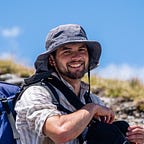
As New Zealand’s highest ever pressure system swept over the country the rain clouds gathered over the Kāweka Range. Regan and I had planned a Wellington Tramping and Mountaineering Club (WTMC) to Kiwi Mouth Hut in the Kāweka, but a day of walking up a river in a snowstorm was a hard sell. Instead we cast our eyes west till they eventually settled on the hinterland of Whanganui National Park. Away from the centre-piece of the park, the Whanganui River, were the Matemateāonga and Puteore tracks which had recently been recut. These two tracks were once linked by a track which turned them into a circuit. There was scant information on the internet about the route, but it was too tantalising an opportunity to pass up. Our punters Andrew and Jordan were keen for the plan change, what’s the worst that could happen?
1. Curdling kebabs
Kohi Saddle to Omaru Hut
We left Wellington straight after work, crossing over Transmission Gully as the sun set over the Kāpiti Coast. Traffic was light and we were soon at the kebab shop in Bulls getting our fill of doner. Just passed Eltham we left the main roads behind, finding ourselves on a succession of smaller and smaller roads. Soon Regan had us pressed to the car doors as we flew around the corners.
“Just checking, how much further till we get to the car park?” — Jordan
It was 10pm when we arrived at Kohi Saddle where the Matemateāonga Track starts. Jordan promptly exited the car. We soon heard her kebab resurface. She was a trooper though, no complaints to be heard. From the car park we crossed a stile onto a 4WD road, our headlights illuminating the surrounding bush. Soon we crossed another stile to start the track proper in the forest.
The Matemateāonga Track traverses the range of the same name. Māori used the range as a route between Ramanui on the Whanganui River and Taranaki. The Crown began purchasing land in the area off Ngā Rauru Kiitahi and Te Iwi o Whanganui in the late 19th and early 20th centuries. The land proved rougher than expected, with thin soils making farming difficult. Access was also an issue, leading to the cutting of a pilot track known as “Whakaihuwaka Road” along the Matemateāonga Range in 1911. This was intended to link Stratford to Raetahi (and the Main Trunk Railway) via a planned bridge over the Whanganui at Parinui. This was never developed as the First World War intervened followed by the collapse of settler farming interests along the river in the 1920s. The milling of the forests was considered but was judged to be uneconomic. Instead most of the land become state forest reserves before being incorporated into Whanganui National Park in 1986 as the Government dismantled the Forest Service to create the Department of Conservation in 1987.
There was no discernable elevation gain or loss as we trundled along the track. Punga hung over the track, often sheltering the reflective (and vaguely demonic) eyes of possums. Regan had been touting the abundance of glow-worms but succeeded in finding a singular worm. Meanwhile I managed to startle two kōura that had been happily hiding in a stream. After an hour of stomping along the track we found an empty Ōmaru Hut. We left our muddy boots at the door and soon we were curled up in our pits, fast asleep.

2. A day of two “halves”
Ōmaru Hut to Puteore Hut, via Whakaihuwaka and the infamous link route
Despite a cold night in the hut we were in good spirits in the morning. The day had dawned bright blue and beautiful, with orange rays illuminating the tree tops. It was 8.30am when we set off. The track was indeed well cut although the winter wetness had turned parts of the track into a bit of a quagmire.

This failed to slow us down, soon we entered a small clearing where the track meets the old road down to Whangamōmona. A little further on, a large sign welcomed us to Whanganui National Park (we had been in the Whangamōmona Forest Conservation Area).

From here the track wound its way along the northern flank of Whakaihuwaka, punctuated by the occasional bridged stream. From time to time the bush opened up giving us a glimpse of a snowy Ruapehu. Around 2.5 hours from leaving Ōmaru we found ourselves at the turn off to the summit of Whakaihuwaka. We had been making good time so far so it reasoned that we would continue to do so. With that in mind Jordan and Andrew joined me on a jaunt up the mountain whilst Regan waited for us at the junction. The climb was initially steep and only got steeper. Thankfully we had left our packs behind, making life a lot more enjoyable.

The climb eventually relented and we began to traverse, passing under a large bluff studded with fossils. We soon found ourselves on a ridge and after a few false summits we broke out into the clearing at the summit. A weathered trig stood here watching wistfully out over the expanse of lower hills, the forms of Taranaki and Ruapehu glistening in the distance.

The round trip took about an hour all up. At the track junction we found a cold Regan wearing all his layers looking like the Michelin Man. Thankfully the sun was shining and with a bit of movement he soon warmed up. We reached the site of the old Humphries Hut around 12pm and decided since it was such a lovely spot we should stop here for lunch.

Following lunch we continued on, soon reaching the point where my old topo indicated we should reach a track junction. Here is lay the first omen of what was to come. No junction, or sign of a junction, was forthcoming. The Auckland Tramping Club account of this link track had mentioned track markers, so I had been hopeful we would find some. In the absence of markers, we opted to bash our way up the hill following the approximate line of the old track on the topo. The lack of foot trail compounding our navigation difficulties, although something obviously travelled along the saddle here. I advocated to stay on the ridge, at least we would have something to follow. Travel was slow and the ridge was less than obvious as it continued. Compounding this was the fact that this was Jordan’s first time off track. It was a great relief then when we finally found our first marker. It soon became clear that the track line marked on the 2019 topo was imprecise. The markers led us in a different direction, sticking to the ridge before dropping to a saddle before climbing to pt 703. From here we found a marker dropping to the southeast but the trail ran cold there. Rather than look for the non-existent track we headed blindly down the hill, ending up in a gully of sorts. It had taken several hours to get to this point, not even a kilometre from where we had come off the Matemateāonga Track.
“Decision time guys — should we turn around?” — Regan
My heart sunk to the words, my pride potentially clouding my judgement. “She’ll be right” I thought. No one spoke against continuing so we went on. Rather than continue down the gully and potentially end up in Pōuri Stream we opted to climb out to the south where we picked up the ridgeline. Another track marker, hurrah!

Now you might think that once on the ridge the nav would be simple and therefore travel would be faster — you’d be wrong. Although the trail generally stuck to the ridge, the bush was dense and frankly unfriendly. Bush lawyer tugged at our skin and piupiu scratched us to pieces. Huge sections of treefall only added to our fun.

Minutes turned into hours, time slipping through our fingers as we inched our way south. Our wee off-track wander was quickly turning into a type II experience. Yet in our misery there were micro-celebrations. The top of pt 642 was cause for a cheer for it would all be downhill from here, to Pōuri Stream at least.

The sun began to set, turning setting the surrounding bush in a blaze of orange light. It might‘ve been beautiful if it hadn’t signaled the beginning of the night portion of our ordeal. The endless ridge eventually ended, the markers climbing to a small knob before turning left to descend steeply down the hill to the south. Following the markers down this section was difficult, but by sticking to a spur we somehow managed to follow them. The sun finally sank below the horizon and we brought out our headtorches to illuminate our path ahead. There was always much conferring as to the next move from each marker. Little by little we made progress. Soon the stream could be heard, somewhere down below us in the darkness. Markers ejected us out onto the stream’s steep bank, which took some negotiating to reach flat ground.
By this point we were all exhausted and over the situation, but there was little opportunity to feel self pity. Hopping across the stream we had a break on the silty stream bank. Sour squirms came out to lift the flagging morale. I told myself there was just one 300m climb to go and then we’d be there. Markers were elusive so Regan forged a route up through vertical scrub. We diligently followed behind. After a bit of a scramble we found ourselves on a plateau. This was welcomed but also quite confusing as it didn’t correspond to where we should be on the map.
“Oh shit… we’re on the wrong side of the stream” — Regan
This statement was confusing as we knew we had to cross the river, how could we be on the wrong side? Then it clicked. The markers had led us upstream of where Pōuri Stream joins Ōmaru Stream. We should have followed the stream down a short way to the confluence and crossed Ōmaru before climbing. Bugger. I raised if we should give up on the hut and camp out; we had already started making silly mistakes and we were nowhere near the hut. However, Regan was comfortable with continuing so we went on. Retracing our steps we were soon back at Pōuri Stream. Passing a bend we discovered the confluence. It was 7pm.
My headtorch couldn’t illuminate the murky depth of the water. Logs lay strewn in the water. Regan went first, ending up waist deep in the cold water before making it to the other side. I took Jordan’s pack and hoisted it on top of mine before beginning my crossing. I like my undies dry so I opted to navigate the mess of logs, gingerly stepping across their submerged masses. This enabled me to get across with just wet calves. Jordan soon followed, leaving just Andrew on the far bank. As Regan scouted ahead Andrew decided he didn’t want to get wet boots so he went about swapping shoes. This made me a bit shitty as all I really wanted to was go to bed. However, I knew expressing this would achieve nothing so I zipped my lips and dealt with it. Whilst I was busy sulking an almighty crash came from the bush behind me. All I could make out were Regan’s legs — stuck up in the air underneath a log. Expletives followed. Luckily all that was damaged was Regan’s pole and his dignity. He even managed to find a marker in the process of collecting himself.
We began slowly up the hill, with Regan losing the markers and leading us straight up a vertical gut that blurred the lines between tramping and rock climbing. Regan waited for me to be halfway up this before calling out saying he had found an easier way (and the markers) on top of the scrubby spur. Progress was frustratingly slow.

Now I insisted on taking Jordan’s pack to speed us up. The downside of this was it meant I couldn’t really look up the steep hillside in front of me. This is where Andrew redeemed himself. Walking out in front of us he found marker after marker, all I had to do was follow the sound of his voice. There were still a few extremely steep sections which required me to pass Jordan’s pack up to Andrew, but we were finally making progress.
From the 500m contour the gradient lessened and we followed the ridge along. This was similar to the travel earlier in the day, with more piupiu and treefall to contend with. The forest began to open up as we neared the 600m contour, much to our relief. Travel from here predominately followed the low undulating ridgelines, making the nav a bit easier, although we had to be careful not to follow the wrong spur off. Since the travel was getting easier I gave Jordan’s pack back to give my neck a break. Following the high points we began travelling faster, going west through the open bush till we were climbing Puteore itself. The first suggestion that we were nearing the track proper came in two green posts that presumably once held a DOC sign.

A short distance further up the hill and a much more complete sign marked the summit of Puteore and the junction with the route between Puteore and Tahupo huts. I let out a squeel of joy. This track had been recut a few years ago so we knew the travel would be much easier. High fives all round. Regan with dinner (or chivalry — you choose) on his mind took Jordan’s pack for this final descent to the hut. It was around 11pm when we passed through an open clearing, then a short climb. Suddenly I could see it, the object of my desires for the past 14.5 hours — Puteore Hut.
There wasn’t time to dwell on this accomplishment as it was already so late. A pot of water was promptly put on to boil and I set about lighting the fire to bring some warmth back to our souls. After Regan had one of his infamous sponge baths (not even a 14.5 hour day will stop him) he set about preparing a hearty dinner and dessert which we all thoroughly enjoyed. It was well after midnight by the time we finally drifted off to sleep, our day’s toil finally over.

3. Resurrection
Puteore Hut to Kohi Saddle
I woke just before 8am but knew Regan would kill me if I woke him up before his alarm went off at 8:30am. I put the billy on to boil and then ventured outside. The morning was crisp, a frost covered the ground while the tops of the trees were only just warming up with the heat of the morning sun. I kept warm by sawing up some fresh firewood to replenish what we had used the night before. By the time I had finished the billy had well and truly boiled so I set about making my morning coffee whilst the others began to stir to the sound of Regan’s alarm. A quick glance in the hutbook revealed the hut only sees about four parties a year, a surprise given how cosy it was. It was around 9:30am by the time we left the hut, enjoying the relative novelty of a cut track.

There were still a few patches of treefall that had to be cut through, but nothing like the scale of the day prior. We followed the ridge behind the hut, enjoying views out on the surrounding ranges. From pt 625 (Whareatai) we descended to pick up an old benched track that wove its way around the contours of the range.

The relatively good track meant that we made quick progress, soon reaching the first of the clearings marked on the map. The lush podocarp gave way to mānuka scrub here, marking the edge of a farm that had long since been abandoned. Given we felt that we were making such excellent time we stopped here for a snack, lapping up the sunshine in all its glory.

Following our break we continued on through a mess of mānuka and fern, the track being a little harder to follow here. Still it was a billion times better than our ordeal the day before! A hour further on and we entered the much larger “Charlies Clearing” where the main farm had been.

Charlie’s Clearing got its name from Charlie Reinhardt, one of three brothers (Charlie, Otto and Albert) who along with their mother and Otto’s wife Elsie attempted to farm the area along “Puteore Road” at Taurakawa in the 1920s and 30s. They had 15 dairy cows, some of the milk being used to feed up wild pigs that were later eaten. The family lived an extremely isolated life. Charlie would walk 13km once a week to get the mail and if wished to go to town, had to walk a further 13km to catch a ride with one of the locals. The onset of the depression made life tough, with brother Albert having to leave as the farm could not sustain all of them. In 1931 Otto and Charlie got a contract from the county council to open up the last 2km of Puteore Road from a pack track to a formed road. This ended up in disaster when Otto accidently ignited a stick of gelignite, taking off his little finger and part of his palm in the process. The road was opened by 1934 so a truck could be driven all the way to Taurakawa but it was constantly plagued by slips. The farm was eventually abandoned around 1936, the Reinhardts being the last settlers to leave the area. The land was last grazed in 1987.
Travel was predictably easy through the clearing although the track wasn’t very well marked. Huge pines dominated one part of the former farm whilst a gigantic herd of goats grazed another.

At the far end of the clearing we went back into the bush, soon picking up the remnants of Puteore Road. This was much wider than the benched track we had been following before. Jordan’s foot full of blisters was starting to play up so despite the easy track we had begun to slow down. The biggest obstacle we encountered was a deep ravine to the northeast of pt 673. Four punga trunks bridged this ravine, tied together with a bit of twine and some orange ‘safety’ netting. Regan went over first and I found some comfort in his safe arrival on the far side (if but for my own sake!). I went next, the trunks bouncing unnervingly under me with every step. Jordan looked less than thrilled. A few brave steps into her crossing she decided that walking wasn’t for her. Instead she proceeded to awkwardly get down to saddle the bridge before crawling across.

With Jordan securely over Andrew crossed without issue. We followed the path of a quadbike that had set deep tracks into the soft mud on the road. Regan took Jordan’s pack, speeding us up dramatically (although it physically pained me to watch Jordan quickly hobble on her messed up feet). We passed over a saddle and the bush on our left dropped away dramatically revealing the snowy peak of Taranaki.

Our burst of speed didn’t last — we crawled past the pine covered pt 514 before descending to a junction in the road. This was “the Letterboxes”. One road (and the quadbike tracks) did a 180, dropping towards Puniwhakau. In the other direction what was Whaka Road disappeared into the forest.
When Bill Godkin returned from WWI with a Scottish bride Ellen he was balloted onto a block of land near the junction of Puteore and Whaka roads. Initially they lived in two large tents before a large hut was constructed out of native timber and corrugated iron. Later the Godkin’s planted a number of fruit trees around the hut and grew sweetpeas in little fenced paddocks. The family enjoyed such luxuries as a piano and a swimming pool! The area around where the hut once was is now known as the ‘daffodil patch’ on account of the flowers that still linger. At the junction a hole was dug into the grey papa at the junction to serve as a letter boxes to receive mail and goods that were sent from Douglas. The Reinhardts also used the ‘letterboxes’, leaving a golden syrup tin with tea leaves in the hole for a cuppa on the journey into town.

After a quick break at the letterboxes I took Jordan’s pack again and we headed into the bush. This section was much rougher than what we had been on so far, having not benefited from any recent chainsaw work. As a result we had to negotiate numerous treefall. Scrub also grew thick on the track. Despite these trials, the navigation was relatively simple. We soon stumbled onto what is left of the formed section of Whaka Road, marked as a 4WD track on the map. Here we ignored the large walkway sign, the easy walking down the road too tempting. After a kilometre we jumped over a tiny saddle to rejoin the Matemateāonga Track. From here it was “something like” a kilometre till we stumbled onto Kohi Saddle. It was 5pm. Our ordeal was at an end.

It definitely won’t be a trip I’ll forget in a hurry. To the credit of Andrew or Jordan, neither of them moaned for the entire trip, despite the 14.5 hour day. To be honest I feel guilty for leading them into such an affray. There was a very clear decision point when we’d come off the Matemateāonga Track, covering about 300m an hour… However, retrospect is a beautiful thing. The best thing to do in this sort of situation is to take the learning onboard, be thankful that we made it through okay and laugh about the experience over a beer (once the scars have healed).