The Beauty of Volcanic Activity from Space through Satellite Imagery
Discovering Active Volcanoes From Space

A guest blog post by Martin Kelko
Foreword by Sentinel Hub
Welcome to our Sentinel Hub Medium guest blog post series! As an integral part of our vibrant community, we are delighted to bring you the diverse perspectives and insights of our valued users. Each post in this series represents the unique experiences, expertise and creativity of individuals harnessing the power of Sentinel Hub services. From innovative applications to ground-breaking research, these guest blog posts offer a glimpse into the myriad ways our users are leveraging satellite imagery and data to explore, analyse and address real-world challenges. We’re excited to provide this space for our community to share their stories and inspire others on their journey with Sentinel Hub.

Volcanic activity is a powerful force of nature that can have profound and far-reaching effects on both the environment and human populations. Monitoring volcanic activity is crucial for early detection, risk assessment, and disaster management. In recent years, advancements in technology, particularly satellite imagery, have revolutionised the way volcanologists monitor and study volcanoes.

Volcano Discovery
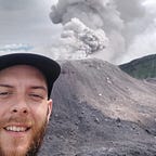
As a volcanologist working as a volcano co-guide and news editor for Volcano Discovery for the past five years, I find monitoring volcanic activity through satellites to be among the most fundamental sources to keep and manage up-to-date volcanic events as they occur worldwide.

Alongside regularly updating detailed narratives of volcanic activity at approximately daily intervals, satellite imagery acquisition and its processing significantly assist me in determining and defining the characteristics of volcanic activity. Detecting active volcanoes encouraged me to study the principles and fundamentals of remote sensing, programming, and modern applications.

About one year ago, at the time of this article, I started to delve deeper and play around more with various EO Browser custom scripts. Back then, I mostly used the predefined true color+IR highlights evalscript in the volcano theme, having zero experience with digital art.

Sentinel Hub’s educational repository: webinars, tutorials, and inspiring satellite imagery masters
I discovered the Sentinel Hub’s comprehensive education workflow webpage, where I’ve been exploring several webinars, tutorials, user guides, and the entire collection of useful custom scripts. Meanwhile, I discovered a masterpiece of satellite imagery processed by Pierre Markuse and Iban Ameztoy, who inspired me to start image processing.

I usually process Sentinel-2 (occasionally Sentinel-3) combinations of thermal anomalies of volcanoes with various types of natural color visualizations. I like this combination by far the most. To perform image enhancements, I use QGIS for georeferencing and raster graphics editors (GIMP.org and Adobe Lightroom) to make images prettier.


Visualizations
In addition, the EO Browser (and the latest Copernicus Browser) also offers options to create beautiful and effective time-lapses of volcanic activity. Easy access to the browser allows you to select the area of interest (AOI) by navigating to the desired location on the map and drawing a rectangle or polygon around the region you want to capture. You are also free to specify the time range for your time-lapse.
As time went by, I commenced processing synthetic-aperture (SAR) radar animations and datasets acquired by Sentinel-1. From a volcanological point of view, I find SAR animations powerful since SAR can penetrate through darkness, clouds, and rain and is highly capable of detecting lava flow development, erosion resulting from eruptive activity, etc.


Indeed, I enjoy creating optical visualizations and 3D animations as well.


Conclusion
The EO Browser platform’s user-friendly interface, abundant data sources, and a diverse range of predefined views have collectively created an enjoyable experience, compelling me to become a frequent visitor each day so far.
EO Browser by Planet stands out as a remarkable tool that brings the marvels of Earth’s landscapes to our fingertips. This powerful platform harnesses the capabilities of satellite imagery, providing users with a unique and visually stunning perspective of our planet.
The Sentinel Hub team would like to thank Martin Kelko for his constant contribution to the Earth observation community. You can get in touch and find his work on X (Twitter) and LinkedIn.
We recommend the Sentinel Hub Educational page and the Custom Scripts webinar to learn more about satellite imagery and custom scripts. You can also visit a dedicated topic in the Sentinel Hub Forum for more information.