Homepage
Open in app
Sign in
Get started
Archive
soar.earth
Tagged in
Mine
Soar
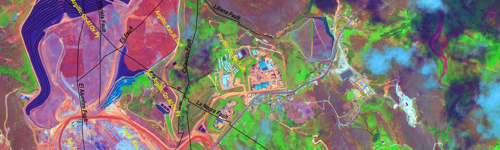
Soar is a cutting edge mapping platform that can integrate multiple resolution imagery feeds from satellite, aerial sensors as well as crowd-sourced drone content.
More information
Followers
373
Elsewhere
More, on Medium
Mine
Darren Smith
in
Soar
Nov 9, 2020
Expert Remote Sensing Hobbyist Shares His Insight on SkyMap50 High-Resolution Multispectral Satellite Imagery
Read more…
1