AbdishakurPython 3D Power Made Easy with Leafmap & MapLibreNew MapLibre Integration With LeafmapJun 201Jun 201
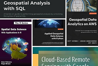
AbdishakurYour Roadmap to Geospatial Data Science in 2024 with 4 Essential BooksConquer the TerrainDec 22, 20233Dec 22, 20233
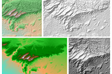
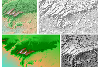
AbdishakurHow to Use Python to Create and Analyze DEM SurfacesThe Essential Surface Tools in Python for DEM — Part 1Aug 30, 2023Aug 30, 2023
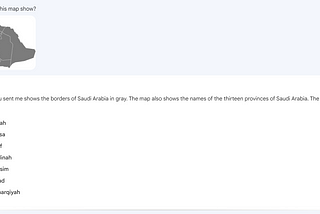
AbdishakurGoogle Bard’s New Photo Prompt with Geospatial DataIs Google Bard’s New Photo Prompt an excellent tool for Geospatial Data?Jul 18, 2023Jul 18, 2023
Abdishakur6 New Must-Read Books in Geospatial Data ScienceUnlock the Power of Geospatial Data Science with These New BooksJul 10, 20233Jul 10, 20233
AbdishakurThe Future of Geospatial AIFrom text generation to Segmenting ImagesApr 16, 20232Apr 16, 20232
AbdishakurGeo-Python Package statistics in 2022 and the outlook for 2023What does the data reveal?Feb 12, 20231Feb 12, 20231
AbdishakurThe Most Essential Geospatial Data Science Newsletters You can FollowTo keep up, get tips and learn valuable skills in Geospatial.Feb 9, 2023Feb 9, 2023
AbdishakurA Helping Hand from AI for your mapping and GIS analysisCan ChatGPT help you get geodata and do GIS Analysis?Jan 24, 20231Jan 24, 20231
AbdishakurThe Best New Books To Study Geospatial Data ScienceRecent Books in Geospatial Data ScienceNov 23, 2022Nov 23, 2022