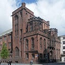
A Walk Along the Cornbrook Part 7: University of Manchester Campus
Original content by Dr John Piprani. Edited by Grant Collier.
Upstream from Greenheys the Cornbrook makes a right turn, running under Tuer Street and past the Arthur Lewis Building. It crosses Oxford Road to run through the Kilburn Building and then winds its way across campus to Upper Brook Street. The University of Manchester Geographer, Dr Martin Dodge, discusses here the culvert section that runs from Tuer Street to Upper Brook Street, and how the culvert’s changing route directly reflects developments to this section of the university campus over the past 100 years or so.
Contained in the culvert beneath the campus, the Cornbrook is controlled and made more efficient for development above. It passes by the Bridgeford Street Building, formerly named the Kantorowich Building but since renamed — possibly to distance the University of Manchester from the latter’s connections with South African Apartheid. The Arthur Lewis Building, which also sits along the route of the Cornbrook, commemorates the life and work of Professor Arthur Lewis, the Nobel Prize-winning economist. Apart from scattered remnants such as Waterloo Place, most of the housing that surrounded the Cornbrook was swept away by the development of the university in the 1960s.
Discussion points:
- What do the names of places tell us about what we value today? Should place names change if the subjects are no longer considered appropriate for commemoration?
- Has the institution of the University of Manchester had a positive impact on its neighbours?

