A night crossing to outrace a storm
Published in
6 min readJun 18, 2018
For three full summers I sailed the waters of Nova Scotia, Prince Edward Island and New Brunswick aboard my little CL16 dinghy, Celtic Kiss, a Canadian variant of the UK’s famed 16-foot Wayfarer.

- For three full summers I sailed the waters of Nova Scotia, Prince Edward Island and New Brunswick aboard my little CL16 dinghy, Celtic Kiss, a Canadian variant of the UK’s famed 16-foot Wayfarer. I initially left my homeport of Halifax, Nova Scotia and sailed clear around the country and up to the Strait of Canso channel to my childhood home of Pirate Harbour. The journey was delightful, but it left me wanting more. What if, I wondered, I could sail my dinghy clear up the unforgiving Northumberland Strait to Confederation Bridge, the interprovincial link between Prince Edward Island and New Brunswick. The journey would be 1,000 miles altogether, and I was pretty sure my little vessel and I were up to the challenge.

- I began my second journey in Pirate Harbour and made it as far as Wood Islands, Prince Edward Island when a relentless northwesterly rolled in, preventing me from beating up the Strait to the Bridge. I waited three days, peering across at Nova Scotia, and plotting how I’d accomplish my goal.
- As is often the case, third time’s the charm, and on my third journey, I launched at Cape John, Nova Scotia and sailed straight across to Wood Islands where I rounded a buoy and continued north. Yes, it made for a bit of backtracking, but if I was going to sail from Halifax to the Bridge, I wasn’t going to cheat any one of those 1000 miles.
- From Wood Islands, with a fair tide behind me, I gybed and steered for Confederation Bridge in Borden, the island home of the original ferry MV Abegweit, which my great-uncle John had once captained (and which is now the headquarters of Chicago’s Columbia Yacht Club). That’s when a strong southwest wind sprang up, transforming the narrow Abegweit Passage from an idyllic sea into an angry monster of large standing waves. Like a determined Rocky Balboa, Celtic Kiss took every punch with stubborn aplomb. As salt spray flew in every direction and walls of water crashed over the bow, I called out to my sea-going ancestor: “C’mon John. I’m here in your honour and could use some help!” Great-uncle John must have heard, because the waves soon became manageable, allowing for a triumphant arrival in Borden.
- From Borden, I sailed under the bridge, then west across the Northumberland Strait to Shediac, New Brunswick, where I decided to take a rest. I’ll never forget the looks on the locals’ faces, nor their hospitality as word spread that some crazy sailor from Halifax had arrived in a 16-foot open boat.
- From Borden, I sailed under the bridge, then west across the Northumberland Strait to Shediac, New Brunswick, where I decided to take a rest. I’ll never forget the looks on the locals’ faces, nor their hospitality as word spread that some crazy sailor from Halifax had arrived in a 16-foot open boat.

- There wasn’t much time for celebrating though: I still had 73 miles between myself and Cape John, so two days later I set off toward Cape Tormentine, New Brunswick, a derelict terminal that was once among the regular stops for the Abegweit. I then left Shediac Bay Yacht Club on a running tide and had an uneventful meander to Confederation Bridge — where everything changed.
- An updated weather forecast warned of 35-knot gusts expected to start in the early morning and then grow into a full-force gale. This forecast, in turn, convinced me to forego Cape Tormentine and sail 36 miles straight through the night in order to outrun the weather. It’s this final leg of the 600-mile journey that I remember best.
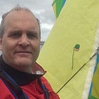
- With the sun setting, I had to move quickly to prepare for the crossing. First, I topped off the fuel tank of my 2hp Honda outboard and placed a reserve jerry can where I could get to it easily, if necessary. After that, I reefed the main in case the wind should spring up quickly and swapped out my lifejacket for a floater jacket and splash pants for warmth and safety. I also tucked the VHF radio into an inside pocket with emergency flares, tethered the GPS and charts to the mast with a flashlight and compass, and placed snacks and drinks nearby, so I could easily keep myself both full and energized.
- Finally, with the sun beyond the horizon and daylight fading, I programmed the GPS for Amet Island and, in darkness, used the Cape Tormentine lighthouse and the lights in the center of Confederation Bridge astern to guide me to the unseen lights of Nova Scotia. In doing so, I couldn’t see where I was going, but I knew where I had been. My night passage had now well and truly begun.

- With reefed main and a trace of wind, I motorsailed just over eight miles at 3.3 knots before the Honda needed a refill. After that I again realigned my stern with the lighthouse and the bridge, trusting that Amet Island was theoretically still in front of me. The moon and stars lit up the night sky brilliantly, in a way only a sailor can experience.
- After another eight miles, the steady drone of the outboard turned into a coughing sputter: time again to quench the thirsty engine. According to the GPS, I was now 20 miles from Amet Island and 23 miles from Cape John.
- It was then, at 0045, that the wind began to build, as did the wave action, and Celtic Kiss began to hobbyhorse awkwardly through the invisible breakers. In an effort to ease her motion, I doused the reefed main, but that made things worse. Knowing the boat was designed to sail and not be power-driven, I hoisted the reefed main again, which immediately dampened Celtic Kiss’s motion through the choppy seas. The clouds continued to roll in, slowly but surely blotting out the stars that had once shone brightly overhead.
- By now it was too rough to lean precariously over the transom to refuel the outboard, so off it went and out came the jib for an exhilarating night sail. By 0245, Celtic Kiss was 17.5 miles from Amet Island and officially in Nova Scotia waters. Not wanting the offshore wind to push me out into the middle of Northumberland Strait, I altered course to sail a bit high of Cape John, telling myself that it’s much easier to run down to a wharf than to beat your way back up to it. At approximately 0530 and well upwind of Cape John, I steered Celtic Kiss for a downwind run directly toward both my destination and the rising sun.

It took me 18 hours to make Cape John, but only 30 minutes to get Celtic Kiss on her trailer. As the sky turned to fiery red, I knew I’d made the right decision. As I looked out in quiet celebration, knowing I’d just eked my way to safety, the Northumberland Strait began gnashing her teeth in earnest, making sure I realized just how treacherous she can be, not to mention how lucky I’d just been.