Jesse NestlerSplitting Hairs with Shapely and GeopandasOr, how to programmatically split line geometries in Python. Or-or, don’t pull all your hair out quite yet!1d ago
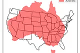
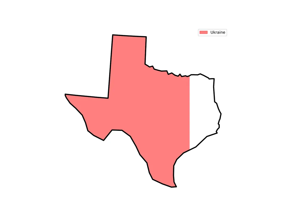
InTowards Data SciencebyLee VaughanPrecisely Compare Geographical Regions with GeoPandasFilling maps with area measurementsOct 83
InAge of AwarenessbyNiken Andika PutriGeospatial Data Analysis in Python: A Case Study for Environmental ApplicationsRecent advancements have greatly transformed how we analyze data, particularly through the integration of geographic information…Nov 121Nov 121
InTierra InsightsbyStephen Chege7 Reasons Why Geopandas is the Ultimate Python Library For Spatial Analysis.Python has a vast amount of libraries from financial analysis, statistics, math and data science making it one of the most versatile…Dec 41Dec 41
InTowards Data SciencebyLee VaughanComparing Country Sizes with GeoPandasHow to project, shift, and rotate geospatial dataJun 25Jun 25
Jesse NestlerSplitting Hairs with Shapely and GeopandasOr, how to programmatically split line geometries in Python. Or-or, don’t pull all your hair out quite yet!1d ago
InTowards Data SciencebyLee VaughanPrecisely Compare Geographical Regions with GeoPandasFilling maps with area measurementsOct 83
InAge of AwarenessbyNiken Andika PutriGeospatial Data Analysis in Python: A Case Study for Environmental ApplicationsRecent advancements have greatly transformed how we analyze data, particularly through the integration of geographic information…Nov 121
InTierra InsightsbyStephen Chege7 Reasons Why Geopandas is the Ultimate Python Library For Spatial Analysis.Python has a vast amount of libraries from financial analysis, statistics, math and data science making it one of the most versatile…Dec 41
InTowards Data SciencebyLee VaughanComparing Country Sizes with GeoPandasHow to project, shift, and rotate geospatial dataJun 25
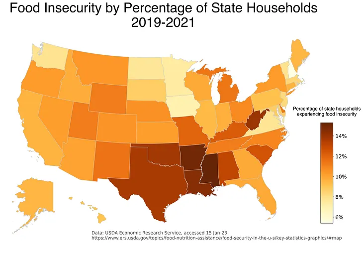
Alex Rich, PhDUse Python geopandas to make a US map with Alaska and HawaiiHere’s one way to make a static choropleth map using geopandas and matplotlib.Jan 16, 20231
Josh CasswellWhere’s the Cheapest Petrol?Using fuel price APIs to produce a moving map JavaScript application for finding the cheapest fuel in an efficient manner. Using GeoPandas…Nov 13
InThe Deep HubbyData95Unlocking Geospatial Data Analysis with GeoPandas: A Comprehensive Python Tutorial and AnalysisExplore the power of GeoPandas in Python through this comprehensive tutorialFeb 33