InTDS ArchivebyLee VaughanUSGS DEM Files: How to Load, Merge, and Crop with PythonA quick guide to prepping digital elevation dataDec 17, 2024
Mohamed SobhiCOG overview and how to create Cloud Optimised GeoTIFF with python.Cloud optimized GeoTIFF is a regular GeoTIFF file with an internal organization like tiling and overviews which can be leveraged by HTTP…May 13, 20241May 13, 20241
Fractal AI ResearchUnderstanding Satellite Image For Geo-spatial Deep LearningA satellite image (not unlike a standard RGB image) can easily be more than 1gb in size. So, we should know how to handle it efficiently…May 18, 2022May 18, 2022
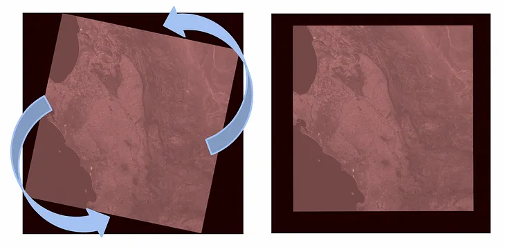
InTDS ArchivebyConor O'SullivanRotating Rasters with RasterioUsing Python to rotate satellite images while maintaining geolocation accuracyAug 7, 2023Aug 7, 2023
InTDS ArchivebyLee VaughanUSGS DEM Files: How to Load, Merge, and Crop with PythonA quick guide to prepping digital elevation dataDec 17, 2024
Mohamed SobhiCOG overview and how to create Cloud Optimised GeoTIFF with python.Cloud optimized GeoTIFF is a regular GeoTIFF file with an internal organization like tiling and overviews which can be leveraged by HTTP…May 13, 20241
Fractal AI ResearchUnderstanding Satellite Image For Geo-spatial Deep LearningA satellite image (not unlike a standard RGB image) can easily be more than 1gb in size. So, we should know how to handle it efficiently…May 18, 2022
InTDS ArchivebyConor O'SullivanRotating Rasters with RasterioUsing Python to rotate satellite images while maintaining geolocation accuracyAug 7, 2023
Bane SullivanVisualizing Rasters in Jupyter was Too Difficult: Introducing localtilleserverI couldn’t find viable solutions for interactively visualizing georeferenced imagery in Jupyter notebooks, so I made a package for it.Jun 3, 2023
Sry Handini PuteriGeospatial Data Processing using Python [Part 1-Accessing The Dataset via STAC]Geospatial analysis has been increasing significantly in the recent couple of years. Analyzing large datasets has been a new norm for…May 15, 2023
Vraj MistrySemantic Segmentation- Satellite ImagesHello Everyone, this is my first blog post about the recent work I did using Rasterio to read GeoTiff files and use them for semantic…Jul 26, 2022


![Geospatial Data Processing using Python [Part 1-Accessing The Dataset via STAC]](https://miro.medium.com/v2/resize:fit:730/format:webp/1*IdvY3kW1swaAnsiO4m73-Q.png)
