Morten Fjord ☀️ ClearSKYSEGES and ClearSKY: Overcoming Cloud Cover for Smart AgricultureAI-powered ClearSKY helps SEGES overcome cloud cover for precise nitrogen recommendations, boosting crop yields and sustainable farming.Nov 21
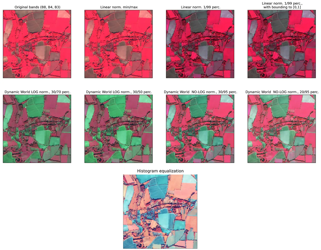
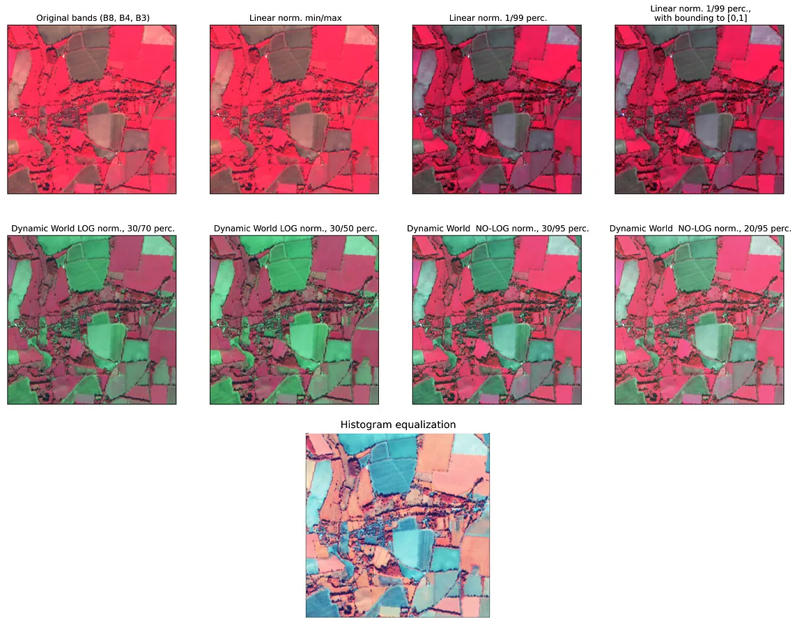
InPlanet StoriesbyEO ResearchHow To Normalize Satellite Images For Deep LearningTackling the long-tailed satellite imagery data for deep learning applicationsSep 27, 20225
Muhammad ShahnoorRemote Sensing Soil Indices | Sentinel-2 | Google Earth Engine 🛰️By Muhammad Shahnoor, Software Engineer & Machine Learning ResearcherApr 29Apr 29
InTowards Data SciencebyCarmen Adriana Martínez Barbosa, PhD.Detecting Clouds with AIFrom Random Forest to YOLO: Comparing different algorithms for cloud segmentation in satellite Images.Jul 17Jul 17
Morten Fjord ☀️ ClearSKYSEGES and ClearSKY: Overcoming Cloud Cover for Smart AgricultureAI-powered ClearSKY helps SEGES overcome cloud cover for precise nitrogen recommendations, boosting crop yields and sustainable farming.Nov 21
InPlanet StoriesbyEO ResearchHow To Normalize Satellite Images For Deep LearningTackling the long-tailed satellite imagery data for deep learning applicationsSep 27, 20225
Muhammad ShahnoorRemote Sensing Soil Indices | Sentinel-2 | Google Earth Engine 🛰️By Muhammad Shahnoor, Software Engineer & Machine Learning ResearcherApr 29
InTowards Data SciencebyCarmen Adriana Martínez Barbosa, PhD.Detecting Clouds with AIFrom Random Forest to YOLO: Comparing different algorithms for cloud segmentation in satellite Images.Jul 17
InPlanet StoriesbyMaxim LamareLooking at the right angle — easy Sentinel 2 BRDF correction with Sentinel HubA simple implementation of angular normalisation for Sentinel-2 reflectance within Sentinel Hub.Apr 13, 20231
Muhammad RidhoHow to Create Sentinel-2 Cloud-Free Images and Generate NDVI in Google Earth EngineSentinel-2 satellite imagery provides valuable data for monitoring the Earth’s surface. However, dealing with clouds in remote sensing…Sep 6, 20231
InPython in Plain EnglishbyKokaTicProducde Soil Wetness Index (SWI) maps Using Sentinel-2 DataPractical guide & ressource to calculate SWI from Sentinel 2 ESA data — in El Oued, Algerian DesertAug 5