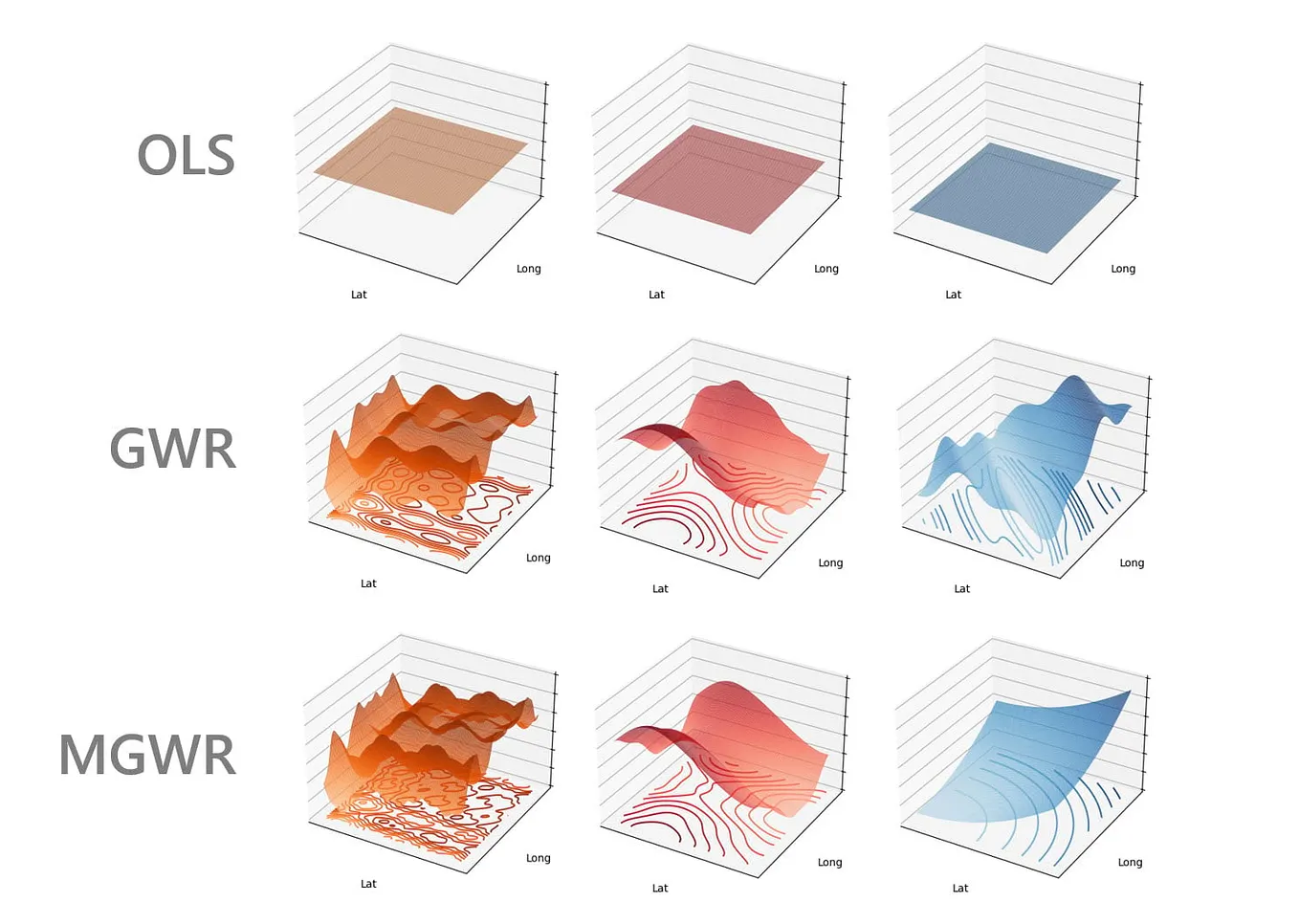
Abdelrahman AhmedUnpacking Spatial Heterogeneity: A Dive into Geographically Weighted RegressionWhen studying spatial data, it’s easy to assume that relationships between variables remain constant across an entire area. But what if…13h ago
Savaş AltürkTaking Geospatial Data Analytics to the Next Level with Panel, DuckDB and MapLibreContentJan 251
Inessa TregubovaComparing Spatial Datasets of POIs. Analysing Foursquare Places (Part 2)This is the second post about Foursquare Places — and also a story about how to compare point clouds from two different spatial datasets.Mar 29Mar 29
Alexandros KazantzidisOptimizing Carpooling with PostGIS: The Ride Matching Algorithm Behind Job RiderJob Rider is a mobile app that helps people create carpooling groups to make their daily commute to work easier. I believe that the most…Mar 16Mar 16
Abdelrahman AhmedUnpacking Spatial Heterogeneity: A Dive into Geographically Weighted RegressionWhen studying spatial data, it’s easy to assume that relationships between variables remain constant across an entire area. But what if…13h ago
Savaş AltürkTaking Geospatial Data Analytics to the Next Level with Panel, DuckDB and MapLibreContentJan 251
Inessa TregubovaComparing Spatial Datasets of POIs. Analysing Foursquare Places (Part 2)This is the second post about Foursquare Places — and also a story about how to compare point clouds from two different spatial datasets.Mar 29
Alexandros KazantzidisOptimizing Carpooling with PostGIS: The Ride Matching Algorithm Behind Job RiderJob Rider is a mobile app that helps people create carpooling groups to make their daily commute to work easier. I believe that the most…Mar 16
Inessa TregubovaExploring an OSM Alternative: A Step-by-Step Guide to POI Data Access and PreparationThis is a first post about my work with a relatively new open data source by Foursquare. I’ll guide you through the process of downloading…Mar 11