Member-only story
Saharan Dust is Staving Off Hurricane Havoc, But For How Long?
Saharan dust can stifle storms — but only if there’s enough of it. Is something even greater than Beryl on the horizon?
In early July 2024, Category 5 Hurricane Beryl struck Grenada, Jamaica, and Mexico, carving a path of destruction on its way to Texas. Beryl broke all the rules. It defied historical precedents in every way, shape, and form, striking more than two months before the peak Atlantic hurricane season. It was the strongest July hurricane ever, surpassing the previous record set by Emily on July 17, 2005, and maintained a ferocious 165 mph (270 kph) intensity for six hours — the average speed of an F1 car in Monza, the fastest track in the circuit.
Ever since, a haunting silence has enveloped the Atlantic. The pressing question is now: when will the ominous quiet be broken by the predicted exceptionally intense hurricane season to come?
But here’s the twist: in the Atlantic, the fate of such storms often hinges on a surprising fifth ingredient. According to a new study, whether a storm becomes a mere drizzle or a devastating deluge largely depends on the dust in the air.
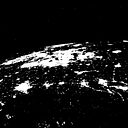
And recently, the Atlantic has been cloaked in dry, dusty conditions from the mighty Sahara desert.

