Golija 1.942 meters above sea level
Beginning of the trail: at 1.450 m.a.s.l. / Peter’s valley, widening of the road at the end of forest trail.
End of trail: The highest peak of Golija mountain at 1.942 m.a.s.l.
Altitude difference: 492 m.
Trail difficulty level: medium II.
Trail length: 5 km.
Climbing time: 2:30 H.
Water on the trail: present. There is a spring on the path heading from Jablan valley to Peter’s valley. This is actually masonry fountain from Turkish era.
Danger: There are no dangerous sections on the trail. The trail is clear sighted and mostly grassy. There is a danger of wildlife. Golija is a well-known bear habitat !
Markers: not any.
Stamp box and registration book: present.
Required fitness: medium.
Optimal period for climbing: summer and autumn.
Brief description of the trail:
This is a mountain hiking tour offering a wonderful view on Vojnik, Morača mountains, Brezna, Komarnica Canyon, Goransko, Boljske grede, Buručkovac, Durmitor, Piva Canyon, Tara Canyon, Ljubišnja, Bioč, Volujak, Lebršnik, Ledenice, Gacko, Krstac, Orjen, Lovćen, etc.
Asphalt road to Golija leads you from Nikšić towards Gacko, and it starts at Gornje Polje, i.e. at the new city bypass, heading over Presjek, Srijeda and Goslić up to Zlostup - where a macadam road leading to Štitari and Višnjići valley is separated. There is an information sign at the crossroad and this is the point where the asphalt road gets closest to the massif of mountain Golija (now appearing before you). On the right side you can now spot Čardak (1.935 m.a.s.l), the second highest peak of Golija.
After driving for a few kilometers along the macadam road you will get to the crossroad: on your left there is a path heading to Visnjici valley (and Piva, as well) while on your right there is another path leading to Jablan valley, the place where forest trails leading to the top of Golija begin. Once you arrive to Jablan valley there are two ways to get to Petar’s valley where the beginning of the trail is; You can either go straight throughout the right part of the valley towards the fountain, masonry fountain and watering place dating from the Turkish era, or you can go left taking the trail that goes around the left part of Jablan valley leading you to the point above the fountain where you will find a shortcut connected to the trail. Taking the forest path from that crossroad, continue to slowly climb through thin forest and glades until you arrive to a clearing offering full view on Golija hillsides. At this clearing, turn left up leaving spacious grassy ravines surrounded by thin forest on your right side. The road goes on for several hundred meters, reaching its end point at 1.450 m.a.s.l. There is a large road extension suitable as parking place. The parking place is at around 7 km from the asphalt road. One part of this road going from Zlostup to Jablan valley is good; from Jablan valley to Petar’s valley the road is fair, whereas the shortcut is shorter but worse.
The trail starts at the end of the forest road and goes straight up to the rounded grassy peak called Jajac which is visible through thin pine forest. The trail is passable, grassy and goes through the thin pine forest with specimens of centuries-old trees. On this part of the trail, we recommend you to orient to the left edge ridge, from which, after leaving the forest, you will reach a wonderful viewpoint in Višnjići valley and Krstac (a place for photographing).
Once you exit the forest you will reach spacious grassy areas which, if you have properly selected the climbing direction to the top of Golija, are favorable ground for climbing. Straight above you there is rounded peak called Jajac at 1.801 m.a.s.l. It looks so appealing that it makes you want to climb to the top of it immediately. However, if you are aiming to climb to the highest peak of Golija, then you have to choose the center of the fold that lies in front of you. It spreads between peak Jajac on the left, and the highest peak of Golija called Čardak visible on the ultimate right. You will easily recognize the central part of the fold by two small dents, and they will be your orientation for hiking further while choosing the cleanest terrain, avoiding rocky areas, swallow holes, etc.
Once you reach the above mentioned fold at 1.800 m.a.s.l, in front of you on south-east there will be the second highest peak of Golija — Čardak (1,935 m.a.s.l.), and highest peak of Golija (1.942 m.a.s.l.) will be on the north-east. As the stone pyramid appears on the highest peak of the Golija, the rest of the trail is quite simple. Just take the shortest way to the pyramid, choosing the cleanest terrain.
The peak is grassy, wide and safe. At its top there is a pyramid with the inscription “1942 m.a.s.l.”. The view from the highest peak of Golija is amazing in all directions.
From the highest peak it is possible to cross to the second highest peak of Golija — Čardak. The distance between these two peaks is about 2 km.
Our rating of attractiveness of this tour (1–5): 4
3D map showing the access road

3D map of the trail

The view on Golija mountain from the road Niksic - Gacko

Turning point towards Golija

The view on Jablan valley


Spring/Fountain

Trail leading from the fountain to the parking place


The view to Visnjici valley from the fold below Jajac peak

Jajac

The trail from below Jajac peak leading to the dents on the fold


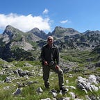
The highest peak of Golija


The view to Durmitor

View from the highest peak over Čardak and Vojnik