Drone technology for community-driven change
How innovation can support Afro-descendant and indigenous communities in Colombia
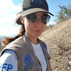
“Colombia has some of the most biodiverse land and waterways in the world. Due to changes in the climate, natural disasters, and population movements, however, these areas are significantly at risk,” warns Adam Marlatt, Senior Technical Adviser for the World Food Programme (WFP).
Despite the country’s rich biodiversity and middle-income status, millions of its people struggle to meet their basic needs, including securing enough nutritious food. Indigenous and Afro-Colombian communities suffer from extreme poverty and the impact of climate change is increasingly felt. The situation is compounded by the recent influx of migrants from neighbouring Venezuela.

Although the activity of armed groups continues to hinder access to vulnerable areas, especially in the poorest regions such as Chocó, Meta and Guaviare, the 2016 peace agreement between the Government and the Revolutionary Armed Forces of Colombia opened the door for humanitarian organizations to access remote, rural parts of the country.
As part of its support to the Colombian Government in addressing food insecurity and malnutrition, WFP is exploring innovative ways to use technology to improve the efficiency and quality of assistance. These include unmanned aircraft systems (UAS), commonly known as drones. Compared to traditional satellite imagery, drones are a cost-effective, highly accurate and versatile tool for data collection that can be used for tasks as diverse as monitoring crops and biodiversity, preparing for emergencies and carrying out post-disaster assessments.
Coupling science with traditional knowledge
IT Officer Fernando Sánchez has worked with WFP in Colombia for 15 years. He first became involved with drones in 2017 when a Colombian private company began monitoring cross-border movements from Venezuela to understand where refugees were settling. “It was inspiring to see how this technology can help United Nations (UN) agencies deliver aid where it is needed most,” he says.
In collaboration with colleagues, in 2017 Fernando proposed a solution to build the capacity of Afro-descendant and Awá indigenous populations along the Colombia-Ecuador border to better understand climate threats.
“Afro-descendants and Awá populations living in the Colombia-Ecuador watersheds suffer from high levels of food insecurity, vitamin and mineral deficiencies, chronic malnutrition and unsatisfied basic needs — a situation made worse by climate variability and shocks,” he explains.
The concept was simple: combining knowledge from local communities as well as from scientific research methods with data from drone technology to rapidly map out indigenous plants, rain forest and watersheds and identify areas that may be at risk, and to mitigate the threats before they become a disaster.

By using chatbots — automated two-ways communication tools — information can be collected from and disseminated to affected populations either through text messages or a mobile app. To encourage further engagement, phone credit will be awarded for every piece of information provided (for instance current weather conditions or crop progress).

“Strengthened institutional and community capacities combined with improved and timely information will lead to better-informed decisions on how to respond to climate variability.”
This information is then complemented with new evidence gathered through UAS technology — for example, through ecosystem vulnerability analysis conducted by drones.
“Strengthened institutional and community capacities combined with improved and timely information will lead to better-informed decisions on how to respond to climate variability and adapt to long-term ecosystem changes, leading to increased food security and improve nutrition,” Fernando says.

This approach can prove useful elsewhere in Latin America and Caribbean. An estimated 45 million indigenous people live in the region and many of them are considered by the UN to be at risk of physical and/or cultural disappearance. Afro-descendant women in the region are still disproportionately affected by poverty.
“Piloting various technology-led projects in Colombia will allow us to easily replicate them in other countries within the region. By developing standard operating procedures and best practices, we will be able to deploy the technology in a more efficient way,” says Ángel Buitrago, IT Officer from WFP’s Panama-based Regional Bureau, who experienced first-hand the relevance of drone technology in humanitarian responses when Hurricane Maria swept through the Caribbean in 2017 and is now supporting WFP’s integration of drones into its operations.
Find out more about WFP in Colombia