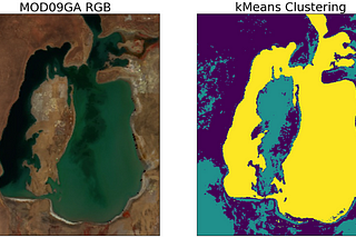
PinnedAleksei RozanovinTowards Data ScienceSemantic Segmentation of Remote Sensing Imagery using k-MeansFrom scratch in python🐍Mar 144Mar 144
PinnedAleksei Rozanov6 python libraries to make beautiful mapsAt some point any Data Scientist faces the need to analyze or model geo spatial data, and it can’t be done without the crucial visual part…Feb 1011Feb 1011
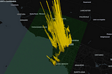
Aleksei RozanovinTowards Data ScienceCan You See the War from Space?Case study of the Russian-Ukrainian war2d ago42d ago4
Aleksei RozanovinTowards Data ScienceDBSCAN, Explained in 5 MinutesFastest implementation in python🐍Aug 231Aug 231
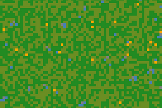
Aleksei RozanovinThe PythoneersSimulating Wildfires in a Forest🔥Using only numpy and matplotlib🐍Jul 135Jul 135
Aleksei Rozanov5 Python Features to Make Your Code More AdvancedEnhance your python🐍 skillsJul 114Jul 114
Aleksei RozanovinTowards Data ScienceErasing Clouds from Satellite Imagery Using GANs (Generative Adversarial Networks)Building GANs from scratch in pythonJun 15Jun 15
Aleksei RozanovinTowards Data ScienceWhy You Don’t Need JS to Make 3D plotsVisualizing crime geodata in pythonJun 1Jun 1
Aleksei RozanovinTowards Data ScienceHow to Create Your Own CV Dataset Using Satellite Imagery: Wildfires from SpaceCollecting images to train CNNsMay 95May 95
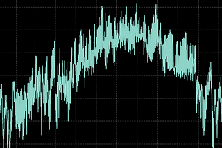
Aleksei RozanovinTowards Data ScienceYou’ve Got a Time Series. Now What?How to do exploratory data analysis of a time seriesApr 205Apr 205