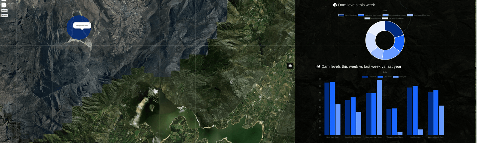
Satellite imagery is becoming an increasingly important tool for farmers and decision-making authorities everywhere…
As you probably already know GEO Premium is our subscription package to get ALL of our online courses in a single…
If not noticed yet, GEO University provides courses that, apart from GIS and Earth Observation, are also…
Maps. The tool for our eyes to comprehend the spatial world at smaller scales. Each map can…
One of the technologies applied in remote sensing projects and research is the LiDAR technology since the 1960s. Nevertheless, many people are still not aware of its existence and its many useful applications and practices.