Homepage
Open in app
GeoAI
Sign in
Get started
Tagged in
GIS
GeoAI
Geospatial Artificial Intelligence: research, proof of concepts, pilot projects on converting raw geospatial data into GIS-grade informational products.
More information
Followers
4.3K
Elsewhere
More, on Medium
GIS
Dmitry Kudinov
in
GeoAI
Oct 27, 2021
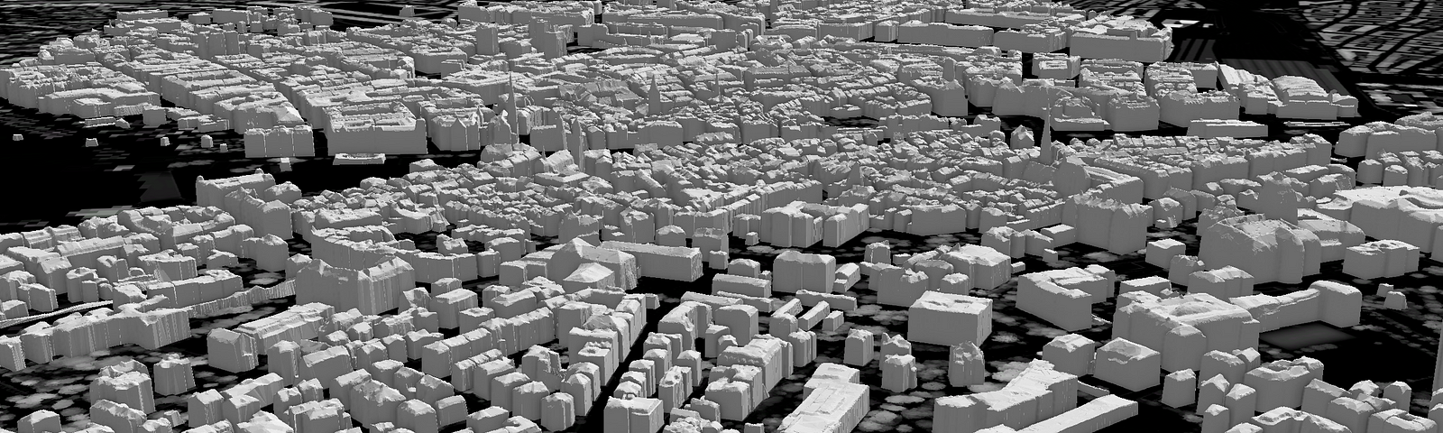
3D Buildings from Imagery with AI. Part 2: Adding Orthophotos.
Read more…
156
Dmitry Kudinov
in
GeoAI
Jul 9, 2021
3D Buildings from Imagery with AI. Part 1: From Elevation Rasters
Read more…
185
Shairoz Sohail
in
GeoAI
Feb 17, 2021
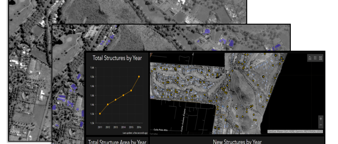
Change Detection of Structures in Panchromatic Imagery
Read more…
180
1 response
Shairoz Sohail
in
GeoAI
Apr 28, 2020
Geospatial Natural Language Processing
How much text and audio content have you consumed this week? Maybe you read a news article…
Read more…
264
Dmitry Kudinov
in
GeoAI
Jan 27, 2020
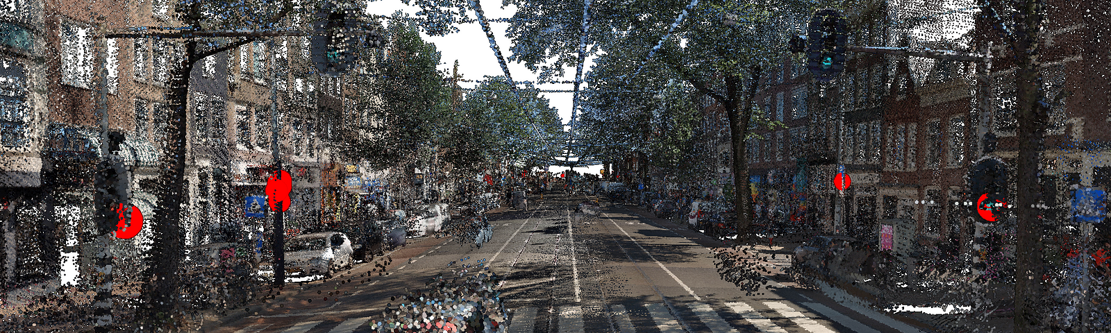
Object extraction from Mobile LiDAR point clouds with Machine Learning
Read more…
366
3 responses
Amin Tayyebi
in
GeoAI
Sep 17, 2019
Automating Railway Asset Detection using Deep Learning
An overview of extracting railway assets from…
Read more…
83
Amin Tayyebi
in
GeoAI
Jul 17, 2019
An End to End Workflow on the Cloud to Monitor Traffic Flow using Deep Learning
Read more…
37
David Yu
in
GeoAI
Jun 6, 2019
Road Feature Detection & GeoTagging
How to utilize MMS data to identify and locate road features for…
Read more…
134
3 responses
Dmitry Kudinov
in
GeoAI
Mar 15, 2019
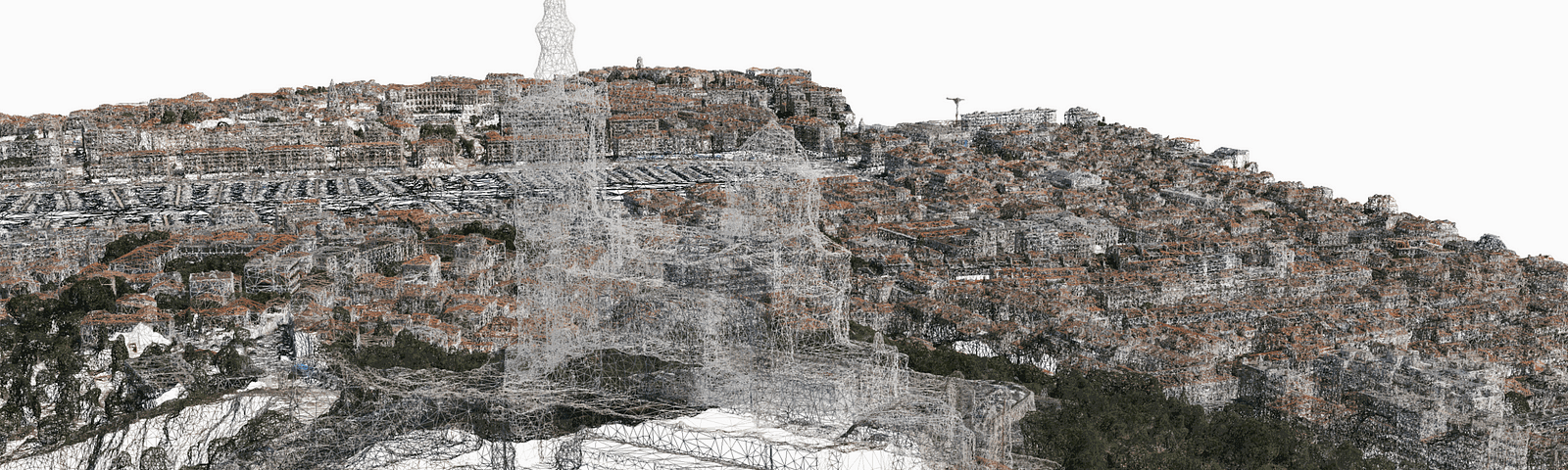
3D cities: Deep Learning in three-dimensional space
Read more…
307
2 responses
Alberto Nieto
in
GeoAI
Oct 27, 2018
Using Forest-based Classification & Regression to Model and Estimate House Values
The ArcGIS Pro 2.2…
Read more…
270
2 responses