Homepage
Open in app
Sign in
Get started
Geodesic
Techniques for turning remote sensing imagery into routing information.
Follow
The blog of GeodesicLabs.com
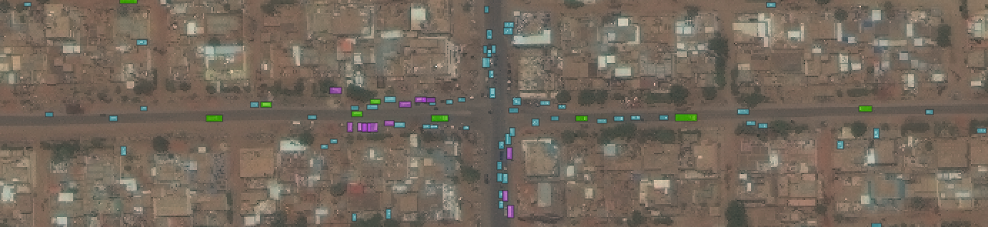
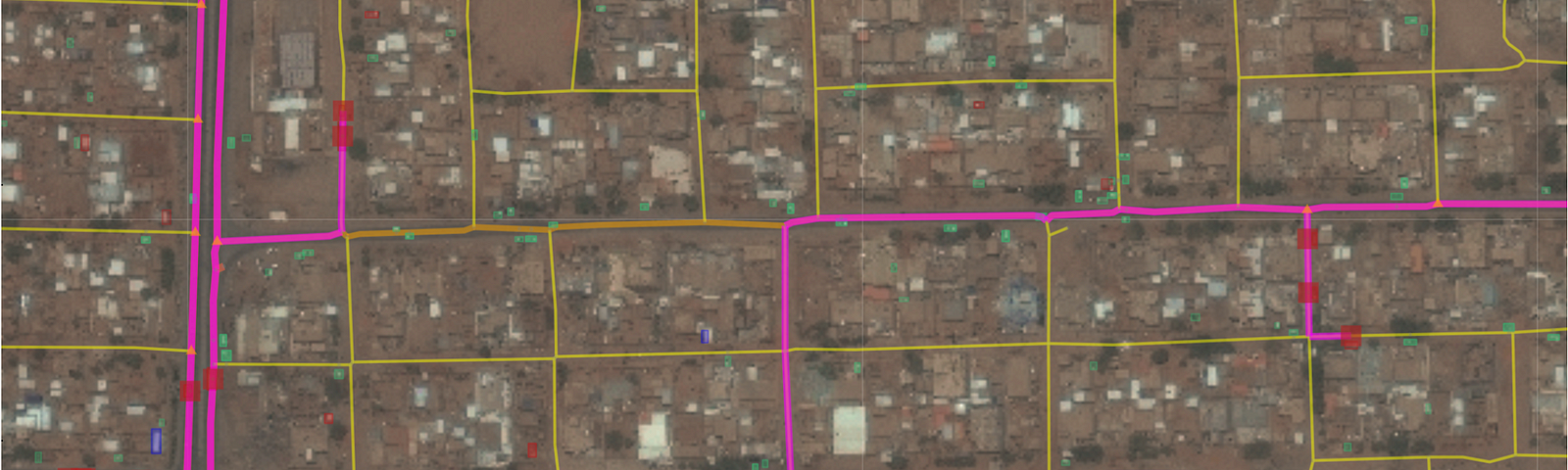
Project Shackleton: Real-Time Routing with Satellite Imagery
Project Shackleton: Real-Time Routing with Satellite Imagery
When standard navigation techniques (i.e. Google Maps) are down and time is of the essence, how might one evacuate from (or position aid…
Adam Van Etten
Sep 6, 2022
Serving up SpaceNet Imagery for Bokeh
Serving up SpaceNet Imagery for Bokeh
A lightweight codebase for building a local tile server for Bokeh applications
Adam Van Etten
May 10, 2022
The Potent Mix of Machine Learning, Satellite Imagery, Vehicles, and Roads: Diet Hadrade
The Potent Mix of Machine Learning, Satellite Imagery, Vehicles, and Roads: Diet Hadrade
A lightweight machine learning codebase for aiding HADR (humanitarian assistance and disaster relief)
Adam Van Etten
Feb 28, 2022
Adam Van Etten
Feb 4, 2022
You Only Look Twice… Again.
Announcing the release of YOLTv5
Read more…
36
1 response
Adam Van Etten
Dec 21, 2021
From Pixels to Pathways
Announcing Geodesic Labs
Read more…
28
About Geodesic
Latest Stories
Archive
About Medium
Terms
Privacy
Teams