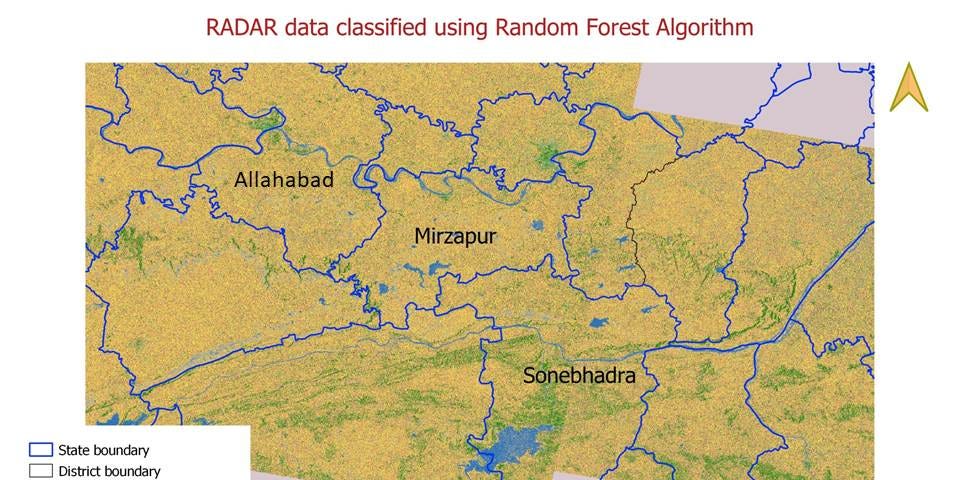
Land use/land cover classification using Google Earth Engine, Random Forest Algorithm, Landsat and Sentinel data: the significance of image resolution