Homepage
Open in app
Sign in
Get started
All stories
How To & Career
Historic Data Viz
We moved to: https://nightingaledvs.com
Tagged in
Maps
Nightingale
We moved to
https://nightingaledvs.com
!
More information
Followers
16.6K
Elsewhere
More, on Medium
Maps
Mathieu Guglielmino
in
Nightingale
Apr 1, 2021
The Rhetoric Behind the Coronavirus Propaganda Maps
Has the power of maps gotten out of control?
Read more…
184
1 response
Alexis Bernard
in
Nightingale
Mar 18, 2021
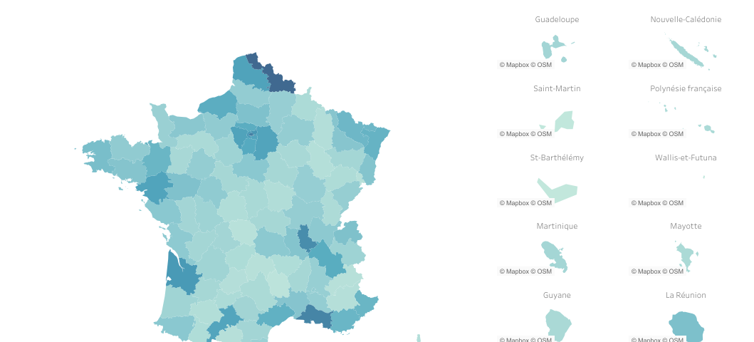
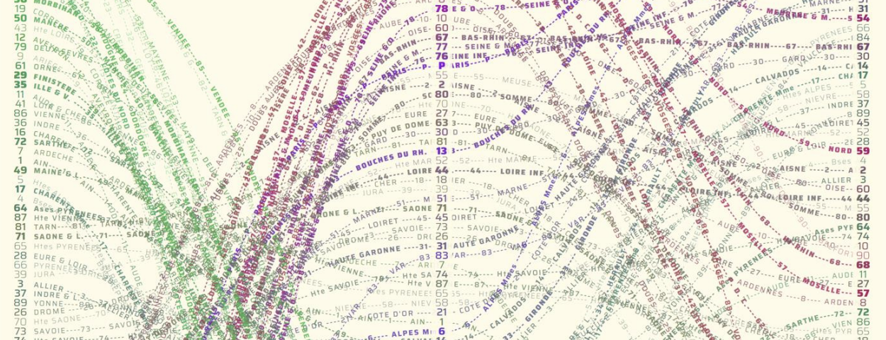
Mapping Overseas France with Tableau
A primer on making granular country maps inclusive of overseas…
Read more…
62
1 response
Carni Klirs
in
Nightingale
Feb 3, 2021
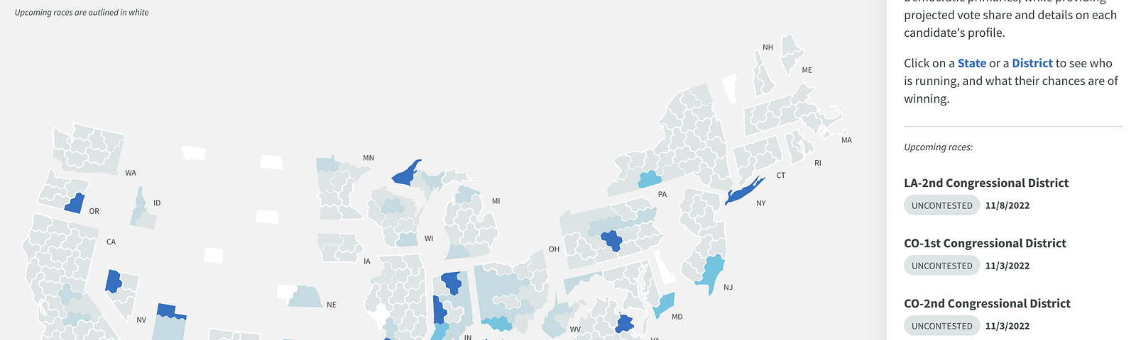
Hexes, Tiles, and Districts
A conversation with Daniel Donner on designing a cartogram of United…
Read more…
74
1 response
Rajesh Sigdel
in
Nightingale
Jan 28, 2021
Understanding Map Projections
Choosing the right projection when visualizing geospatial data
Read more…
135
2 responses
Alexander W
in
Nightingale
Dec 11, 2020
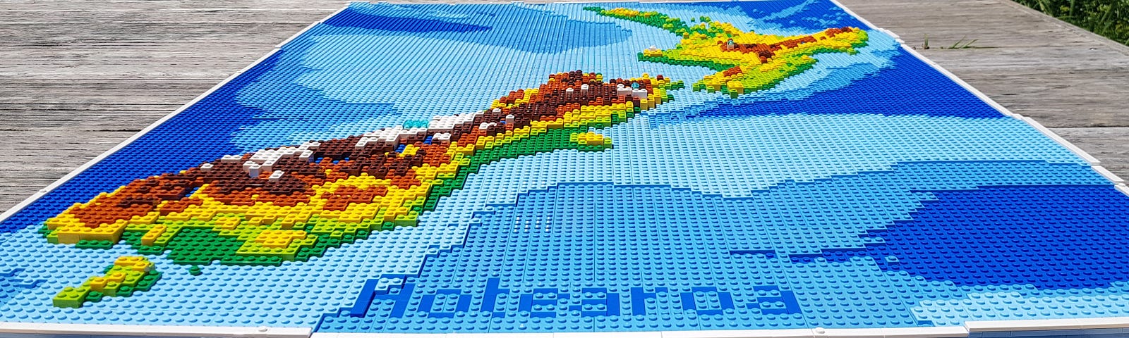
Building Physical Maps…with LEGO
Deconstructing assumptions with data physicalisation
Read more…
59
2 responses
Alec Barrett
in
Nightingale
Oct 29, 2020
Where Data Meets Literacy
A review of Richard Brath’s “Visualizing with Text”
Read more…
114
Aishwarya Ramakrishnan
in
Nightingale
Oct 20, 2020
Data Storytelling with Maps
Choosing the right type of map for the right data and story
Read more…
226
4 responses
Liuhuaying Yang
in
Nightingale
Oct 17, 2020
穿越時空的可視化(5):導視設計的靈感
如何用設計幫用戶抵達看不見的目的地?且看不同文化傳統與時代如何用設計解決導航和導視困境。
編譯者前言
Read more…
28
Emilia Ruzicka
in
Nightingale
Sep 2, 2020
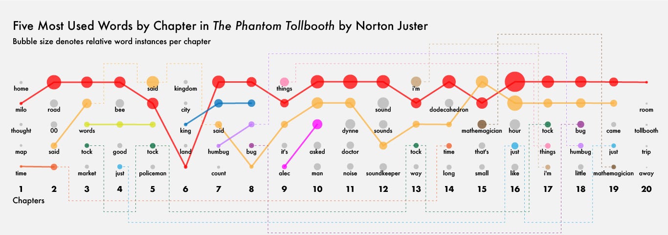
Mapping ‘The Phantom Tollbooth’
Following Milo’s iconic journey through the Lands Beyond
Read more…
117
1 response
Liuhuaying Yang
in
Nightingale
Aug 30, 2020
穿越時空的可視化(4):陸地導航的上半生
從陸地導航的歷史設計,圍繞朝聖、郵驛、商隊的旅行和導航需求,了解信息設計在實際導航運用中所扮演的角色。
編譯者前言
Read more…
125