Tagged in

Maps

NYC Planning Tech
NYC Planning Tech
Notes on data, engineering, software, and design @NYCPlanning
More information
Followers
392
Elsewhere
More, on Medium

Experimenting with planning color standards

In my last post, I described the challenge of using color to visualize 50+ data…


Stitching together map tile fragments

Mapbox Vector Tiles are awesome — and conceptually fascinating. They allow us to create…


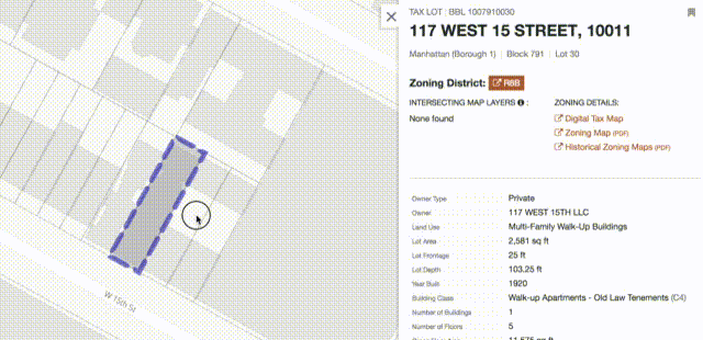
An Erroneous Basemap Label, and how OpenStreetMap and the Community Helped us Fix it

NYC Planning recently launched Community Profiles, a site that compiles indicator data about NYC’s 59 community districts into an organized report with maps, charts, and links to…


Using the new MVT function in PostGIS

We ❤️ vector tiles. They’re a key part of our modern open source spatial stack, and we’ve…