Homepage
Open in app
Sign in
Get started
Dataset Updates
Technical Guides
LINZ Data Service
Tagged in
Open Data
On Location
Dataset updates and technical guidance from Toitū Te Whenua LINZ on location information and geospatial open source software.
More information
Followers
81
Elsewhere
More, on Medium
Open Data
Toitū Te Whenua LINZ
in
On Location
Oct 11, 2020
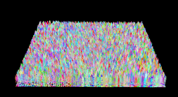
Identifying trees using R
A few of our older elevation datasets often have point cloud classifications…
Read more…
15
Toitū Te Whenua LINZ
in
On Location
Aug 8, 2019
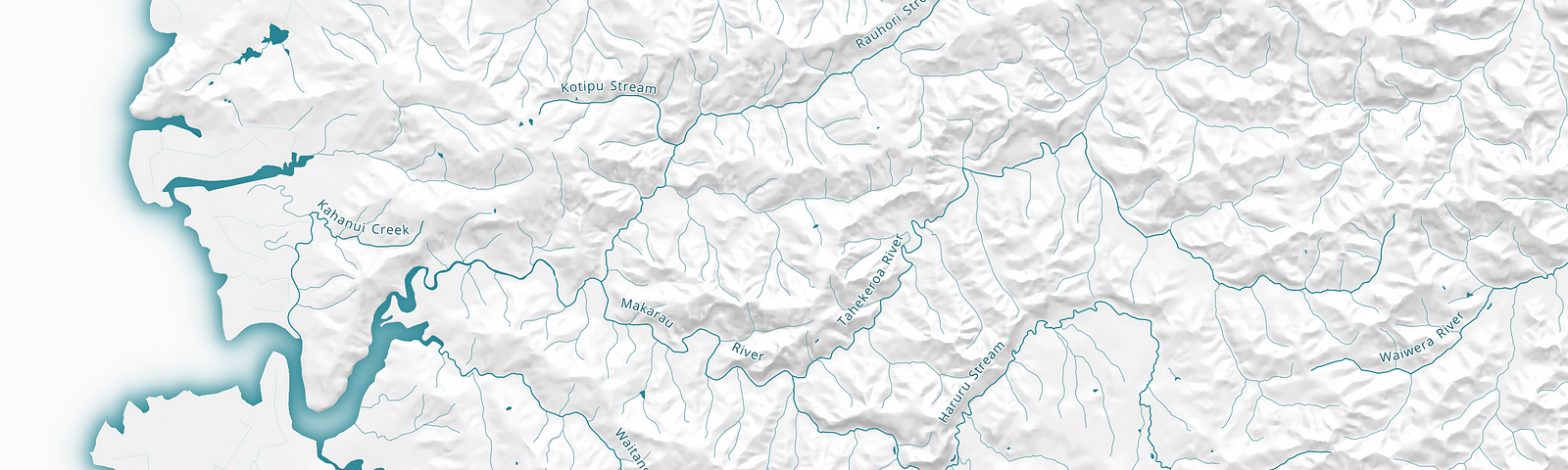
New pilot datasets for river names
We’re pleased to release two new pilot datasets —
NZ River Name Lines
and
NZ River Name Polygons
.
Read more…
19
Toitū Te Whenua LINZ
in
On Location
Jun 4, 2019
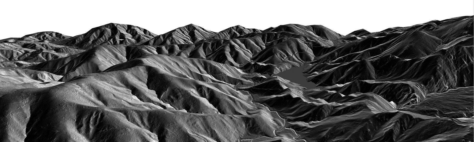
From points to pixels — creating digital elevation models from OpenTopography point clouds
Read more…
10
1 response
Toitū Te Whenua LINZ
in
On Location
May 9, 2019
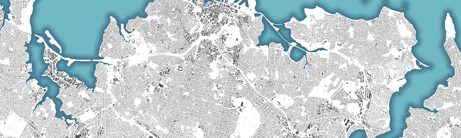
An open building outlines dataset for New Zealand
Read more…
52
1 response
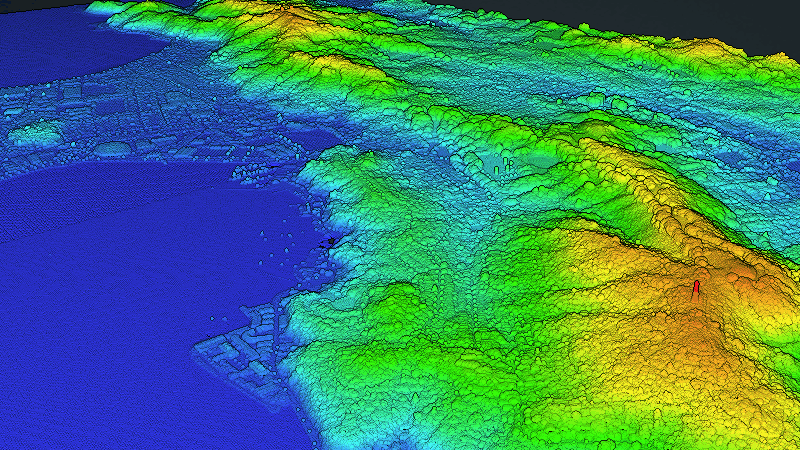
Toitū Te Whenua LINZ
in
On Location
Oct 16, 2018
Creating point cloud visualisations with OpenTopography
Read more…
17