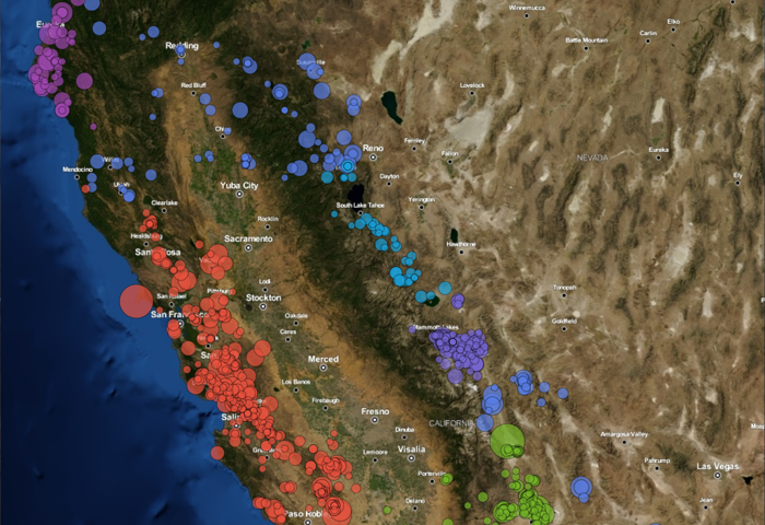
Landsat 8, MATLAB, and the California Drought (Part II)
In the first part of this two part series we looked at how to measure the water level of Cachuma Lake using the Image Processing Toolbox in MATLAB and a Landsat 8 image. We were able to produce a graph showing the decrease in surface…