I’ve struggled all morning on how to set shapefile encodings in R. Finally I got this solution to handle both French and Spanish characters.
Happy coding!
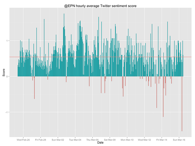
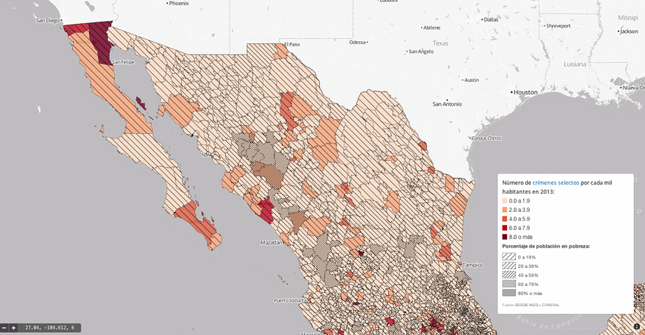
How safe is Mexico? That is a frequent question people ask me. There is even a…
This is a short but sweet post on how to create a geojson file in R . Remember that you can render geojson files in github.
This post shows how to use Google Maps’ API with R making some tweaks to this function. Combine the first part…
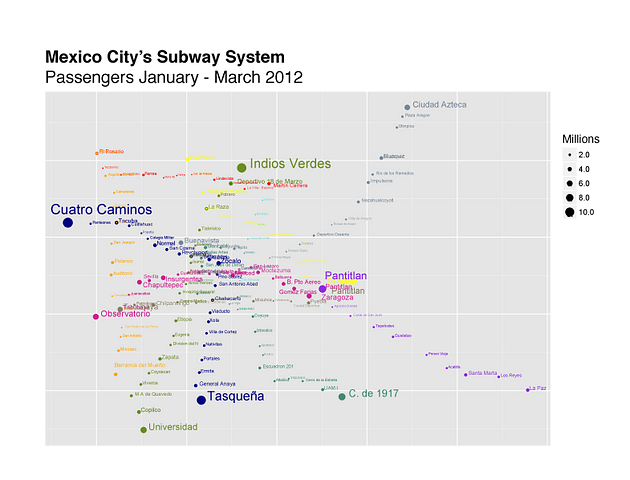
I used R and ggplot2 to make a bubble map of Mexico City’s Metro passenger count from January to February…