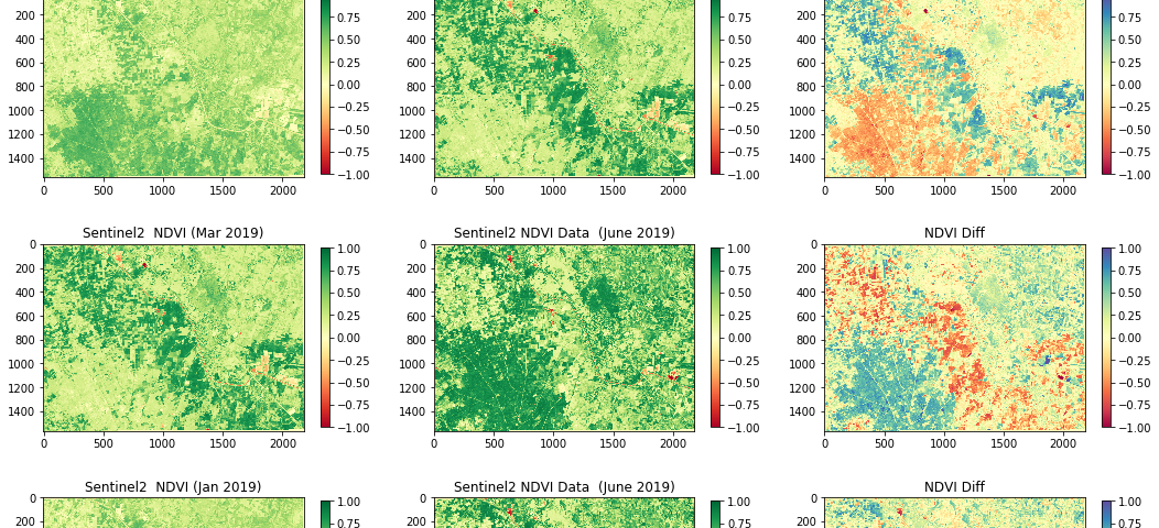
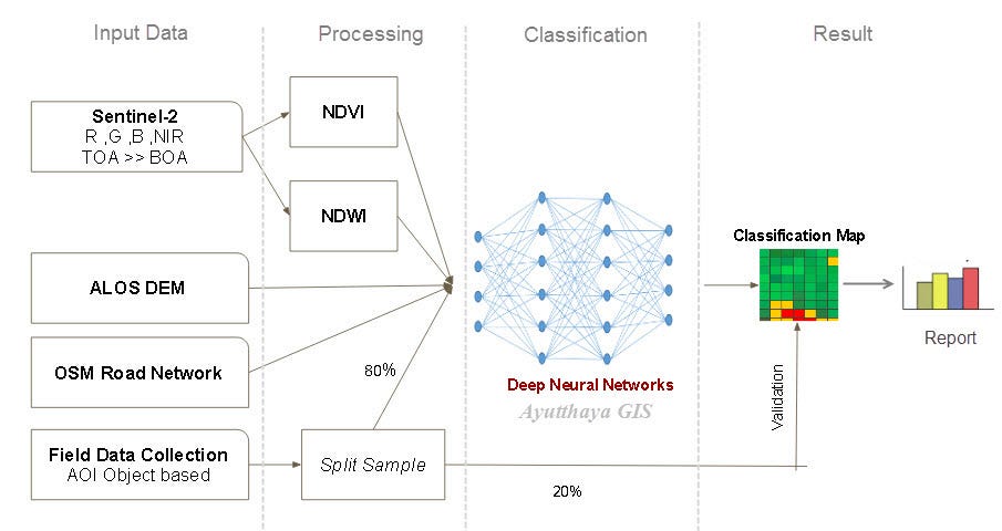
คำนวณหาการเปลี่ยนแปลงของพื้นการเกษตรจากค่าต่างของ NDVI รายช่วงเวลา
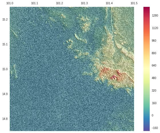
การจัดการและประมวลผลข้อมูลความสูงภูมิประเทศ
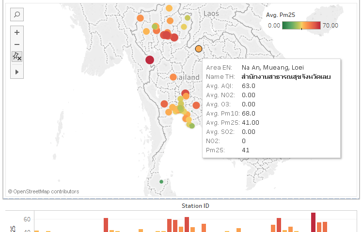
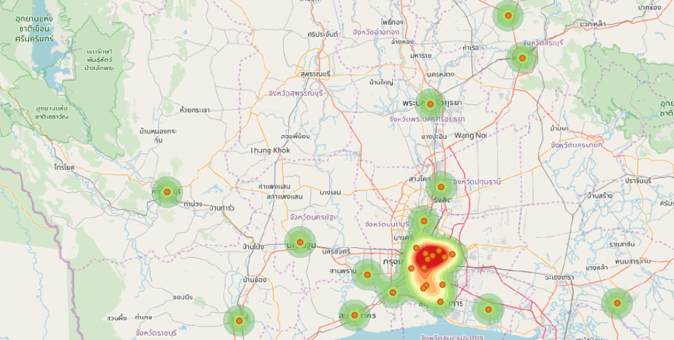
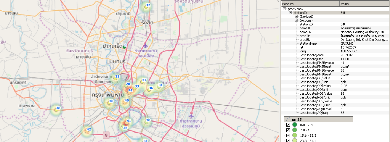
การวิเคราะห์ข้อมูลคุณภาพอากาศ PM2.5 ด้วยสถิติเชิงพื้นที่ ตอนที่ 2
การวิเคราะห์ข้อมูลคุณภาพอากาศ PM2.5 ด้วยสถิติเชิงพื้นที่ ตอนที่ 1
ทำการสร้าง Density Map ในรูปแบบ Hexagonal Grid ด้วยโปรแกรม QGIS
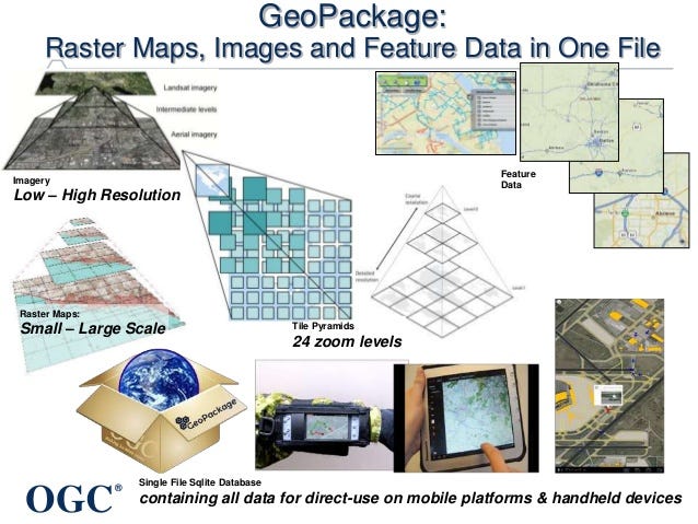
ทำความรู้จักกับระบบจัดเก็บข้อมูลเชิงพื้นที่รูปแบบใหม่ มาตรฐาน OGC.
These were the top 10 stories published by Geo Data Science; you can also dive into yearly archives: 2017, 2018, and 2019.