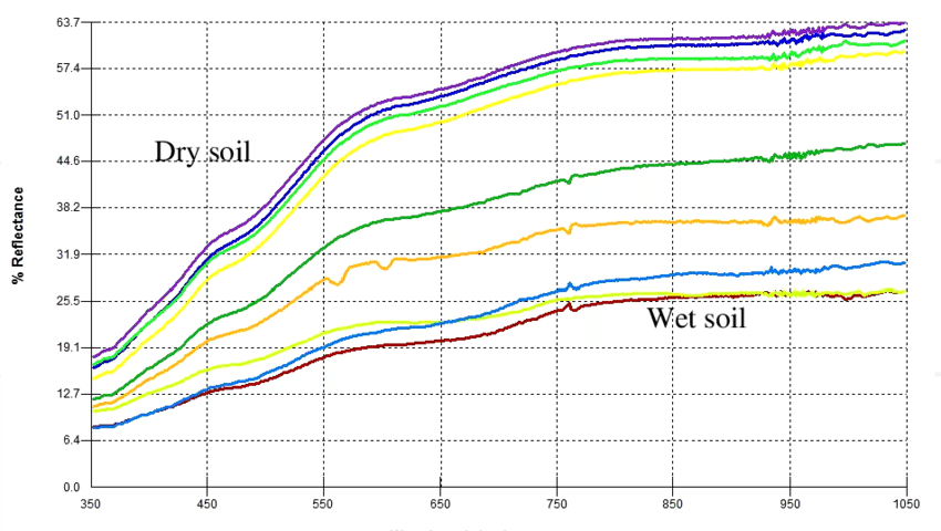
Satellite imagery is becoming an increasingly important tool for farmers and decision-making authorities everywhere…
For farmers and land managers, increasing crop yields and cutting costs while reducing…
Day by day, loads of datasets are added in the Earth Observation imagery archive, introducing more opportunities and higher potential in the resilience and adaptability of the remote sensing domain. One of the operations…