Homepage
Open in app
Sign in
Get started
QGIS
WebGIS
Leaflet
PostGIS
OPENSOURCE
UAVs&Drones
ABOUT
Tagged in
Labels
MAPEDIA BLOG
Sharing ideas, stories, and tech updates
More information
Followers
204
Elsewhere
More, on Medium
Labels
Chingchai Hoomhong
in
MAPEDIA BLOG
Jul 22
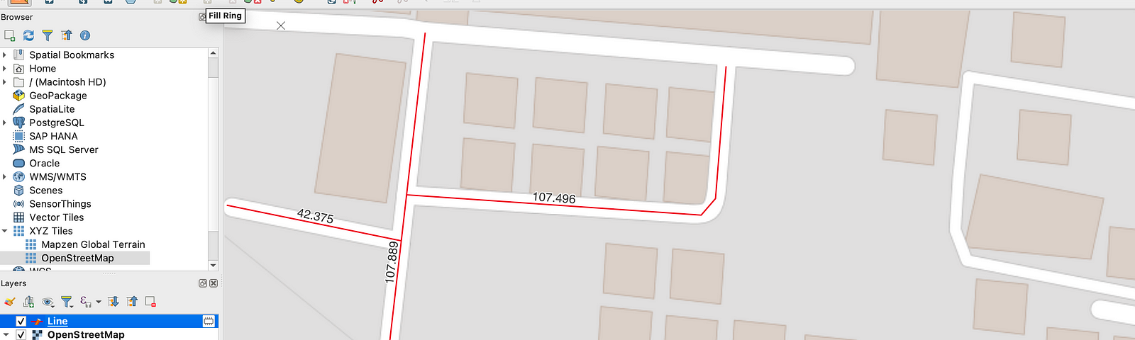
การแสดงระยะความยาวขณะที่ระหว่างเรากำลังดิจิไทซ์ข้อมูล GIS ผ่านโปรแกรม QGIS
Read more…
4
Chingchai Hoomhong
in
MAPEDIA BLOG
Sep 13, 2019
QGIS3 ทดลองใช้เครื่องมือ expression สกัดค่าจากข้อมูล raster และยังสามารถกำหนดสีในรูปแบบ HSL จากข้อมูลได้อีกด้วย
Read more…
2