Homepage
Open in app
Sign in
Get started
QGIS
WebGIS
Leaflet
PostGIS
OPENSOURCE
UAVs&Drones
ABOUT
Tagged in
Qgis
MAPEDIA BLOG
Sharing ideas, stories, and tech updates
More information
Followers
204
Elsewhere
More, on Medium
Qgis
Chingchai Hoomhong
in
MAPEDIA BLOG
Jul 22
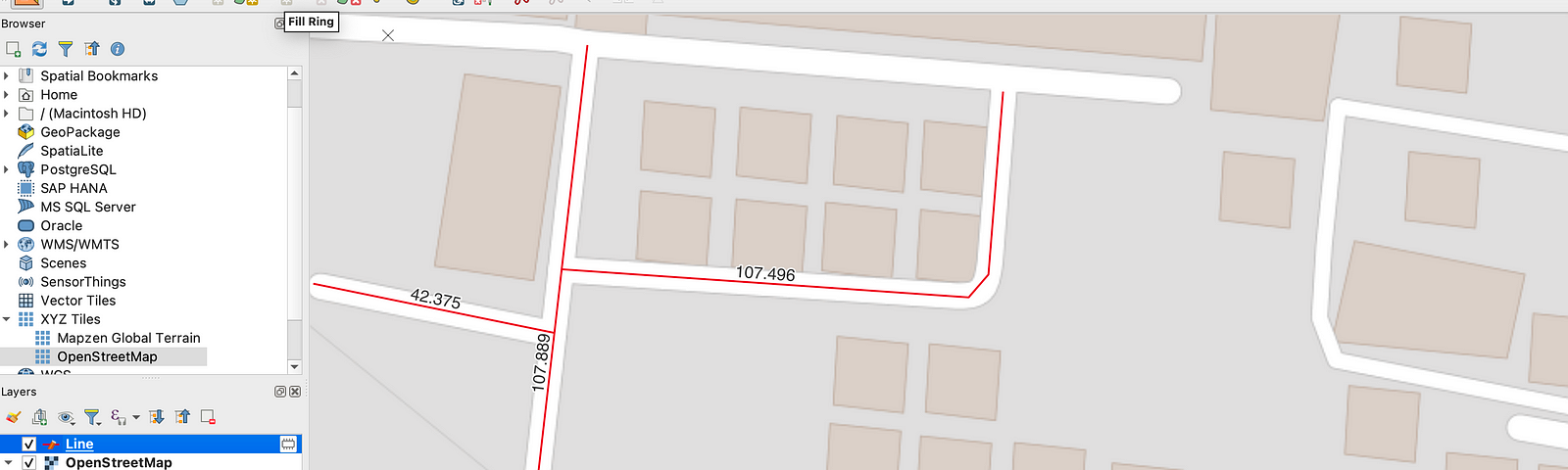
การแสดงระยะความยาวขณะที่ระหว่างเรากำลังดิจิไทซ์ข้อมูล GIS ผ่านโปรแกรม QGIS
Read more…
4
Chingchai Hoomhong
in
MAPEDIA BLOG
Jul 5
แนะนำ 2 วิธีการเรียกข้อมูลแผนที่แปลงที่ดิน ส.ป.ก ด้วยโปรแกรม QGIS
Read more…
Chingchai Hoomhong
in
MAPEDIA BLOG
May 11
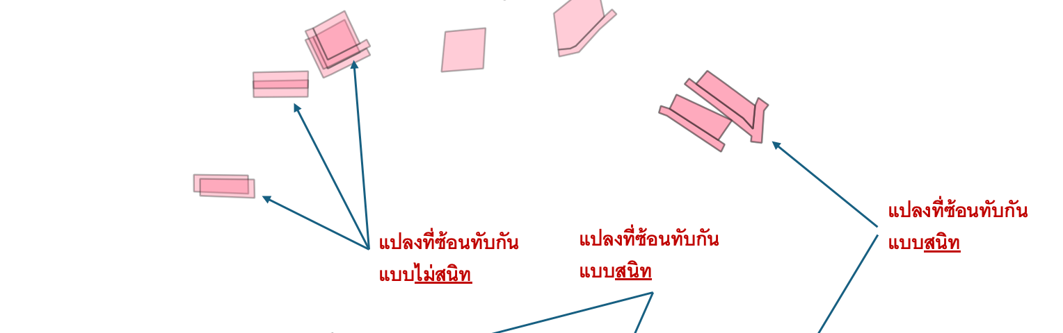
การจัดการกับข้อมูลรูปแปลงที่ดินที่ซ้อนทับกันด้วยโปรแกรม QGIS
Read more…
11
Chingchai Hoomhong
in
MAPEDIA BLOG
Sep 5, 2023
วิธีดาวน์โหลดข้อมูลภาพดาวเทียมจาก Google Maps/Google Earth มาเก็บไว้ในโปรแกรม LTAXGIS
Read more…
11
Chingchai Hoomhong
in
MAPEDIA BLOG
Sep 4, 2023
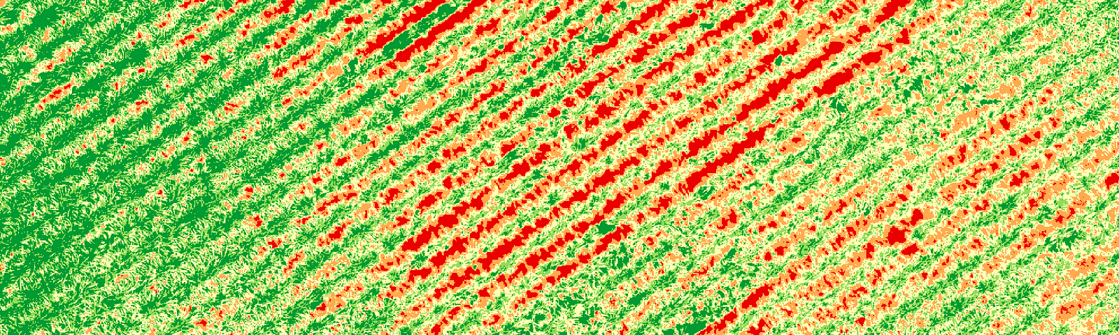
การตรวจสอบสุขภาพพืชด้วยคำนวณหาค่าดัชนีพืชพรรณจากข้อมูลภาพโดรนด้วยโปรแกรม QGIS (Part 2)
Read more…
16
Satap_srm
in
MAPEDIA BLOG
Aug 16, 2023
วิธีกำหนด ID อัตโนมัติ เมื่อสร้าง Feature ใหม่ บน QGIS
Read more…
2
•MAPEDIA•
in
MAPEDIA BLOG
Aug 19, 2023
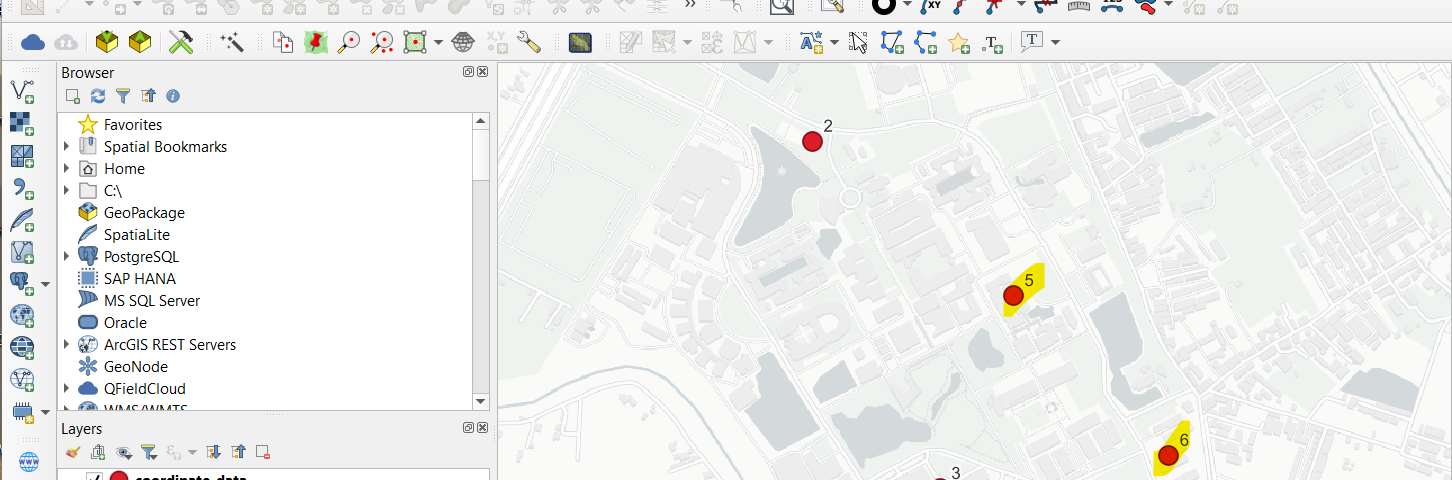
วิธีแสดงข้อมูลจุดพิกัด (Points) จากไฟล์ CSV มาแสดงใน QGIS อัตโนมัติเมื่อมีข้อมูลพิกัดเพิ่มเข้าใหม่
Read more…
11
1 response
Satap_srm
in
MAPEDIA BLOG
Aug 1, 2023
ตั้งค่าการแสดงผลของเครื่องมือ Digitize และเครื่องมือ Select Feature ง่ายๆใน QGIS
Read more…
16
Chingchai Hoomhong
in
MAPEDIA BLOG
Jul 21, 2023
การตรวจสอบสุขภาพพืชด้วยคำนวณหาค่าดัชนีพืชพรรณจากข้อมูลภาพโดรนด้วยโปรแกรม QGIS (Part 1)
Read more…
52
Chingchai Hoomhong
in
MAPEDIA BLOG
Jul 2, 2023
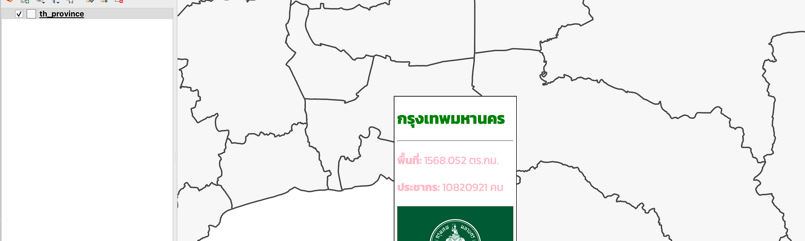
การใช้งานและแสดงข้อมูลด้วย Map Tips ในโปรแกรม QGIS
Read more…
2