Homepage
Open in app
Sign in
Get started
MAPEDIA•BLOG
Sharing ideas, stories, and tech updates
QGIS
WebGIS
Leaflet
PostGIS
OPENSOURCE
UAVs&Drones
ABOUT
Follow
Latest
Trending
Chingchai Hoomhong
in
MAPEDIA BLOG
Jul 22
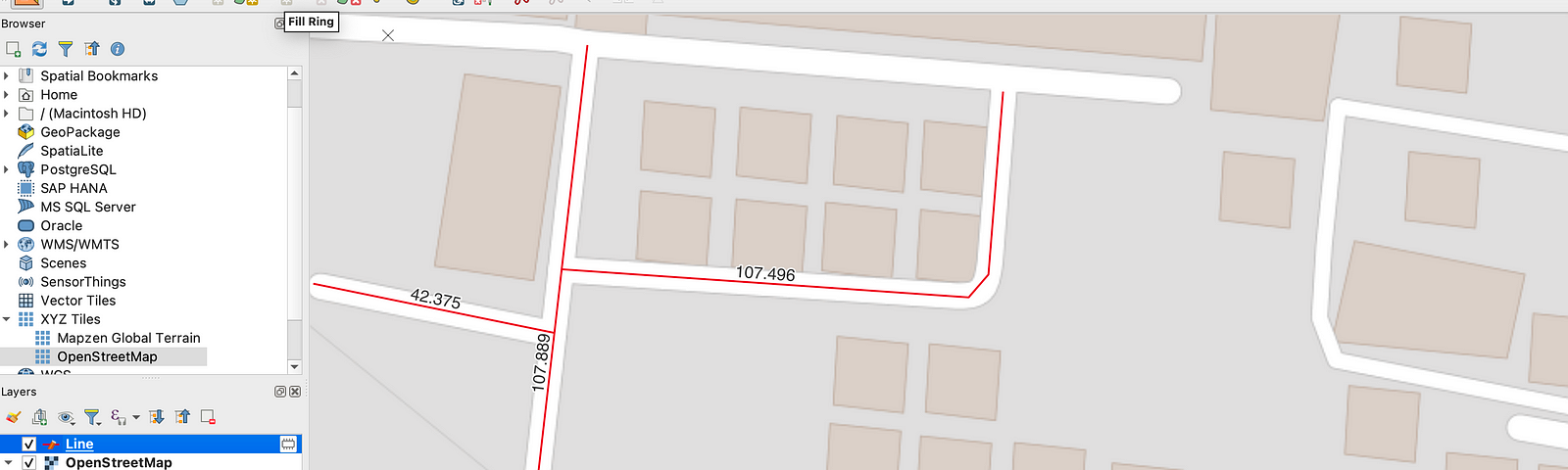
การแสดงระยะความยาวขณะที่ระหว่างเรากำลังดิจิไทซ์ข้อมูล GIS ผ่านโปรแกรม QGIS
Read more…
4
Chingchai Hoomhong
in
MAPEDIA BLOG
Jul 5
แนะนำ 2 วิธีการเรียกข้อมูลแผนที่แปลงที่ดิน ส.ป.ก ด้วยโปรแกรม QGIS
Read more…
Chingchai Hoomhong
in
MAPEDIA BLOG
May 11
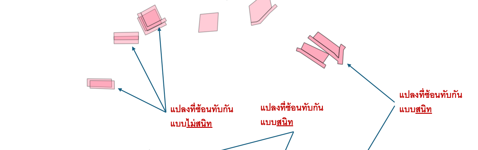
การจัดการกับข้อมูลรูปแปลงที่ดินที่ซ้อนทับกันด้วยโปรแกรม QGIS
Read more…
11
Chingchai Hoomhong
in
MAPEDIA BLOG
Sep 5, 2023
วิธีดาวน์โหลดข้อมูลภาพดาวเทียมจาก Google Maps/Google Earth มาเก็บไว้ในโปรแกรม LTAXGIS
Read more…
11
Chingchai Hoomhong
in
MAPEDIA BLOG
Sep 4, 2023
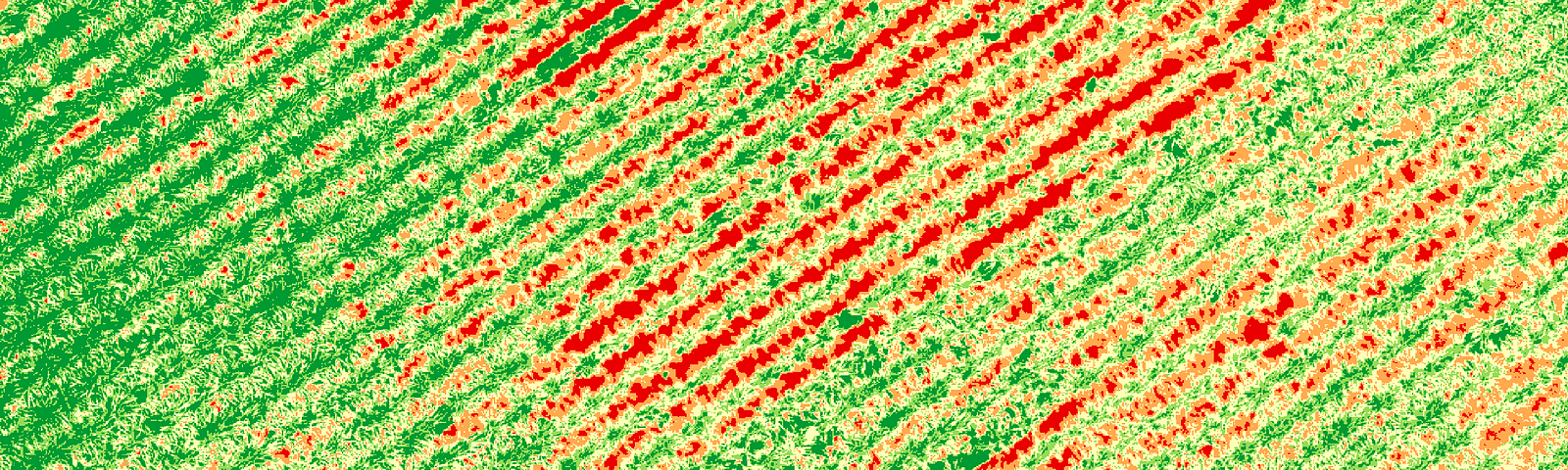
การตรวจสอบสุขภาพพืชด้วยคำนวณหาค่าดัชนีพืชพรรณจากข้อมูลภาพโดรนด้วยโปรแกรม QGIS (Part 2)
Read more…
16
•MAPEDIA•
in
MAPEDIA BLOG
Aug 19, 2023
วิธีแสดงข้อมูลจุดพิกัด (Points) จากไฟล์ CSV มาแสดงใน QGIS อัตโนมัติเมื่อมีข้อมูลพิกัดเพิ่มเข้าใหม่
Read more…
11
1 response
Satap_srm
in
MAPEDIA BLOG
Aug 16, 2023
วิธีกำหนด ID อัตโนมัติ เมื่อสร้าง Feature ใหม่ บน QGIS
Read more…
2
Satap_srm
in
MAPEDIA BLOG
Aug 1, 2023
ตั้งค่าการแสดงผลของเครื่องมือ Digitize และเครื่องมือ Select Feature ง่ายๆใน QGIS
Read more…
16
Chingchai Hoomhong
in
MAPEDIA BLOG
Jul 21, 2023
การตรวจสอบสุขภาพพืชด้วยคำนวณหาค่าดัชนีพืชพรรณจากข้อมูลภาพโดรนด้วยโปรแกรม QGIS (Part 1)
Read more…
52
thanawat.mnk
in
MAPEDIA BLOG
Jul 6, 2023
มาทำความรู้จัก Dronexif สมาชิกใหม่ล่าสุดของ Dronebox
Read more…
10
About
MAPEDIA BLOG
Sharing ideas, stories, and tech updates
More information
Followers
204
Elsewhere